Itakyry geodata
Itakyry (Alto Paraná) is a populated place; located in Paraguay in America/Asuncion (GMT-4) time zone. With population of 3,038 people, there are 81 cities with bigger population in this country. Compared to other cities in Paraguay, 75.9% of cities are located further ↓South; 89.5% of cities are located further ←West and 80.9% of cities have lower elevation than Itakyry. Note1


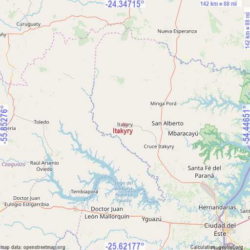
Itakyry GPS coordinates[2]
24° 59' 9.996" South, 55° 8' 58.668" West
| Map corner | latitude | longitude |
|---|---|---|
| Upper-left | -24.34715°, | -55.85276° |
| Center: | -24.98611°, | -55.14963° |
| Lower-right: | -25.62177°, | -54.44651° |
| Map W x H: | 141.7×141.7 km | = 88×88mi |
| max Lat: | -19.91667° ⇑24.1% North |
| Itakyry: | -24.98611° |
| min Lat: | ⇓75.9% South -27.38662° |
| min Long | Itakyry | max Long |
| -60.78333° | -55.14963° | -54.30694° |
| W 89.5%⇐ | ⇒10.5% E |
Elevation
Elevation of Itakyry is 246 m = 807 ft, and this is 76.3 m = 250 ft above average elevation for this country.
| Max E: |
658 m = 2159 ft | 19.1% |
| Itakyry | 246 m 807 ft | |
| Avg. | 169.7 m = 557 ft | |
Min E: |
46 m = 151 ft | 80.9% |
See also: Paraguay elevation on elevation.city.
Geographical zone
Itakyry is located in South temperate zone (between Tropic of Capricorn and the Antarctic Circle). Distance of this Southern Tropic circle is 172.3 km =107.1 mi to North.| Distance of | km | miles | from Itakyry |
|---|---|---|---|
| Equator | 2778.2 | 1726.3 | to North |
| Tropic Capricorn | 172.3 | 107.1 | to North |
| Antarctic Circle | 4623 | 2872.6 | to South |
| South Pole | 7228.9 | 4491.8 | to South |


Nearby cities:
15 places around Itakyry: (largest is in red/bold)
• Capiíbary
91.5 km =56.9 mi,  283°
283°
• Cedrales
86 km =53.4 mi,  150°
150°
• Ciudad del Este
79.5 km =49.4 mi,  137°
137°
• Colonia General Alfredo Stroessner
70.1 km =43.6 mi,  233°
233°
• Colonia Minga Porá
28.5 km =17.7 mi,  62°
62°
• Doctor Juan León Mallorquín
50.5 km =31.4 mi,  192°
192°
• Doctor Juan Manuel Frutos
81.7 km =50.8 mi,  237°
237°
• Nueva Esperanza
61 km =37.9 mi,  29°
29°
• Presidente Franco
84 km =52.2 mi, 139°
• San Alberto
25.3 km =15.7 mi,  85°
85°
• San Isidro de Curuguaty
79.2 km =49.2 mi,  316°
316°
• San Joaquín
90.1 km =56 mi,  267°
267°
• Santa Rita
89 km =55.3 mi,  174°
174°
• Yguazú
55 km =34.2 mi,  164°
164°
• Yhú
78.3 km =48.7 mi,  264°
264°
Sources, notices
• [Note1] Compared only with cities in Paraguay existing in our database
• [Src1] Map data: © OpenStreetMap contributors (CC-BY-SA)
• [Src2] Other city data from geonames.org with taken over terms of usage.
• [Src3] Geographical zone / Annual Mean Temperature by Robert A. Rohde @ Wikipedia
