Nueva Colombia geodata
Nueva Colombia (Cordillera) is a populated place; located in Paraguay in America/Asuncion (GMT-4) time zone. With population of 683 people, there are 154 cities with bigger population in this country. Compared to other cities in Paraguay, 70.4% of cities are located further ↓South; 80.9% of cities are located further →East and 87.7% of cities have higher elevation than Nueva Colombia. Note1


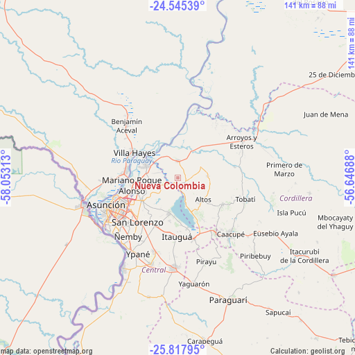
Nueva Colombia GPS coordinates[2]
25° 10' 59.988" South, 57° 21' 0" West
| Map corner | latitude | longitude |
|---|---|---|
| Upper-left | -24.54539°, | -58.05313° |
| Center: | -25.18333°, | -57.35° |
| Lower-right: | -25.81795°, | -56.64688° |
| Map W x H: | 141.5×141.5 km | = 87.9×87.9mi |
| max Lat: | -19.91667° ⇑29.6% North |
| Nueva Colombia: | -25.18333° |
| min Lat: | ⇓70.4% South -27.38662° |
| min Long | Nueva Colombia | max Long |
| -60.78333° | -57.35° | -54.30694° |
| W 19.1%⇐ | ⇒80.9% E |
Elevation
Elevation of Nueva Colombia is 85 m = 279 ft, and this is 84.7 m = 278 ft below average elevation for this country.
| Max E: |
658 m = 2159 ft | 87.7% |
| Avg. | 169.7 m = 557 ft | |
| Nueva Colombia | 85 m = 279 ft | |
Min E: |
46 m = 151 ft | 12.3% |
See also: Paraguay elevation on elevation.city.
Geographical zone
Nueva Colombia is located in South temperate zone (between Tropic of Capricorn and the Antarctic Circle). Distance of this Southern Tropic circle is 194.2 km =120.7 mi to North.| Distance of | km | miles | from Nueva Colombia |
|---|---|---|---|
| Equator | 2800.1 | 1739.9 | to North |
| Tropic Capricorn | 194.2 | 120.7 | to North |
| Antarctic Circle | 4601.1 | 2859 | to South |
| South Pole | 7206.9 | 4478.2 | to South |


Nearby cities:
15 places around Nueva Colombia: (largest is in red/bold)
• Altos
13 km =8.1 mi,  132°
132°
• Areguá
14.8 km =9.2 mi,  193°
193°
• Arroyos y Esteros
29.1 km =18.1 mi,  60°
60°
• Atyrá
20.8 km =12.9 mi,  120°
120°
• Capiatá
21.4 km =13.3 mi,  206°
206°
• Emboscada
3.7 km =2.3 mi,  0°
0°
• Fernando de la Mora
24.4 km =15.2 mi,  224°
224°
• Itauguá
23.3 km =14.5 mi,  181°
181°
• Limpio
13.8 km =8.6 mi,  277°
277°
• Mariano Roque Alonso
18.5 km =11.5 mi,  261°
261°
• San Bernardino
15.2 km =9.4 mi,  159°
159°
• San Lorenzo
23.6 km =14.7 mi, 222°
• Tobatí
28.2 km =17.5 mi,  107°
107°
• Villa Hayes
20.2 km =12.6 mi,  299°
299°
• Ypacarai
25.7 km =16 mi,  166°
166°
Sources, notices
• [Note1] Compared only with cities in Paraguay existing in our database
• [Src1] Map data: © OpenStreetMap contributors (CC-BY-SA)
• [Src2] Other city data from geonames.org with taken over terms of usage.
• [Src3] Geographical zone / Annual Mean Temperature by Robert A. Rohde @ Wikipedia
