Arroyos y Esteros geodata
Arroyos y Esteros (Cordillera) is a populated place; located in Paraguay in America/Asuncion (GMT-4) time zone. With population of 2,455 people, there are 95 cities with bigger population in this country. Compared to other cities in Paraguay, 74.7% of cities are located further ↓South; 68.5% of cities are located further →East and 85.8% of cities have higher elevation than Arroyos y Esteros. Note1


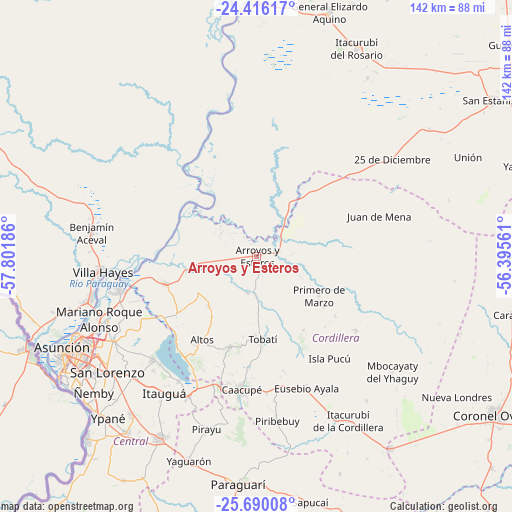
Arroyos y Esteros GPS coordinates[2]
25° 3' 17.208" South, 57° 5' 55.428" West
| Map corner | latitude | longitude |
|---|---|---|
| Upper-left | -24.41617°, | -57.80186° |
| Center: | -25.05478°, | -57.09873° |
| Lower-right: | -25.69008°, | -56.39561° |
| Map W x H: | 141.6×141.6 km | = 88×88mi |
| max Lat: | -19.91667° ⇑25.3% North |
| Arroyos y Esteros: | -25.05478° |
| min Lat: | ⇓74.7% South -27.38662° |
| min Long | Arroyos y Ester | max Long |
| -60.78333° | -57.09873° | -54.30694° |
| W 31.5%⇐ | ⇒68.5% E |
Elevation
Elevation of Arroyos y Esteros is 90 m = 295 ft, and this is 79.7 m = 261 ft below average elevation for this country.
| Max E: |
658 m = 2159 ft | 85.8% |
| Avg. | 169.7 m = 557 ft | |
| Arroyos y Esteros | 90 m = 295 ft | |
Min E: |
46 m = 151 ft | 14.2% |
See also: Paraguay elevation on elevation.city.
Geographical zone
Arroyos y Esteros is located in South temperate zone (between Tropic of Capricorn and the Antarctic Circle). Distance of this Southern Tropic circle is 179.9 km =111.8 mi to North.| Distance of | km | miles | from Arroyos y Esteros |
|---|---|---|---|
| Equator | 2785.8 | 1731 | to North |
| Tropic Capricorn | 179.9 | 111.8 | to North |
| Antarctic Circle | 4615.3 | 2867.8 | to South |
| South Pole | 7221.2 | 4487 | to South |


Nearby cities:
15 places around Arroyos y Esteros: (largest is in red/bold)
• Altos
27.9 km =17.3 mi,  214°
214°
• Areguá
40.6 km =25.2 mi,  225°
225°
• Atyrá
26 km =16.2 mi,  196°
196°
• Caacupé
37.1 km =23.1 mi,  186°
186°
• Caraguatay
34.1 km =21.2 mi,  126°
126°
• Emboscada
27.4 km =17 mi,  247°
247°
• Eusebio Ayala
39 km =24.2 mi,  159°
159°
• Isla Pucú
34.6 km =21.5 mi,  144°
144°
• Limpio
40.9 km =25.4 mi, 252°
• Nueva Colombia
29.1 km =18.1 mi,  240°
240°
• Primero de Marzo
20.3 km =12.6 mi,  122°
122°
• San Bernardino
34.7 km =21.6 mi, 214°
• Tobatí
23 km =14.3 mi,  176°
176°
• Villa Hayes
43 km =26.7 mi,  264°
264°
• Ypacarai
43.7 km =27.2 mi, 205°
Sources, notices
• [Note1] Compared only with cities in Paraguay existing in our database
• [Src1] Map data: © OpenStreetMap contributors (CC-BY-SA)
• [Src2] Other city data from geonames.org with taken over terms of usage.
• [Src3] Geographical zone / Annual Mean Temperature by Robert A. Rohde @ Wikipedia
