Emboscada geodata
Emboscada (Cordillera) is a populated place; located in Paraguay in America/Asuncion (GMT-4) time zone. With population of 5,911 people, there are 50 cities with bigger population in this country. Compared to other cities in Paraguay, 72.2% of cities are located further ↓South; 80.9% of cities are located further →East and 84.6% of cities have higher elevation than Emboscada. Note1


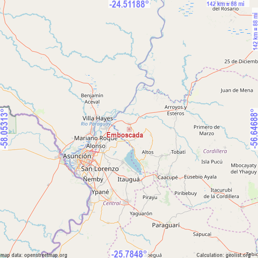
Emboscada GPS coordinates[2]
25° 9' 0" South, 57° 21' 0" West
| Map corner | latitude | longitude |
|---|---|---|
| Upper-left | -24.51188°, | -58.05313° |
| Center: | -25.15°, | -57.35° |
| Lower-right: | -25.7848°, | -56.64688° |
| Map W x H: | 141.5×141.5 km | = 87.9×87.9mi |
| max Lat: | -19.91667° ⇑27.8% North |
| Emboscada: | -25.15° |
| min Lat: | ⇓72.2% South -27.38662° |
| min Long | Emboscada | max Long |
| -60.78333° | -57.35° | -54.30694° |
| W 19.1%⇐ | ⇒80.9% E |
Elevation
Elevation of Emboscada is 93 m = 305 ft, and this is 76.7 m = 252 ft below average elevation for this country.
| Max E: |
658 m = 2159 ft | 84.6% |
| Avg. | 169.7 m = 557 ft | |
| Emboscada | 93 m = 305 ft | |
Min E: |
46 m = 151 ft | 15.4% |
See also: Paraguay elevation on elevation.city.
Geographical zone
Emboscada is located in South temperate zone (between Tropic of Capricorn and the Antarctic Circle). Distance of this Southern Tropic circle is 190.5 km =118.4 mi to North.| Distance of | km | miles | from Emboscada |
|---|---|---|---|
| Equator | 2796.4 | 1737.6 | to North |
| Tropic Capricorn | 190.5 | 118.4 | to North |
| Antarctic Circle | 4604.8 | 2861.3 | to South |
| South Pole | 7210.6 | 4480.5 | to South |


Nearby cities:
15 places around Emboscada: (largest is in red/bold)
• Altos
15.8 km =9.8 mi,  142°
142°
• Areguá
18.4 km =11.4 mi,  190°
190°
• Arroyos y Esteros
27.4 km =17 mi,  67°
67°
• Atyrá
22.9 km =14.2 mi,  128°
128°
• Capiatá
24.8 km =15.4 mi,  202°
202°
• Fernando de la Mora
27.2 km =16.9 mi,  219°
219°
• Itauguá
27 km =16.8 mi,  180°
180°
• Limpio
13.8 km =8.6 mi,  262°
262°
• Mariano Roque Alonso
19.4 km =12.1 mi,  250°
250°
• Nueva Colombia
3.7 km =2.3 mi, 180°
• San Bernardino
18.7 km =11.6 mi,  163°
163°
• San Lorenzo
26.5 km =16.5 mi, 217°
• Tobatí
29.5 km =18.3 mi,  114°
114°
• Villa Hayes
18.6 km =11.6 mi,  289°
289°
• Ypacarai
29.3 km =18.2 mi,  167°
167°
Sources, notices
• [Note1] Compared only with cities in Paraguay existing in our database
• [Src1] Map data: © OpenStreetMap contributors (CC-BY-SA)
• [Src2] Other city data from geonames.org with taken over terms of usage.
• [Src3] Geographical zone / Annual Mean Temperature by Robert A. Rohde @ Wikipedia
