Colonia General Alfredo Stroessner geodata
Colonia General Alfredo Stroessner (Caaguazú) is a populated locality; located in Paraguay in America/Asuncion (GMT-4) time zone. With population of 11,558 people, there are 28 cities with bigger population in this country. Compared to other cities in Paraguay, 60.5% of cities are located further ↓South; 80.2% of cities are located further ←West and 90.7% of cities have lower elevation than Colonia General Alfredo Stroessner. Note1
Current local time in Colonia General Alfredo Stroessner:
01:38 PM, ThursdayDifference from your time zone: hours


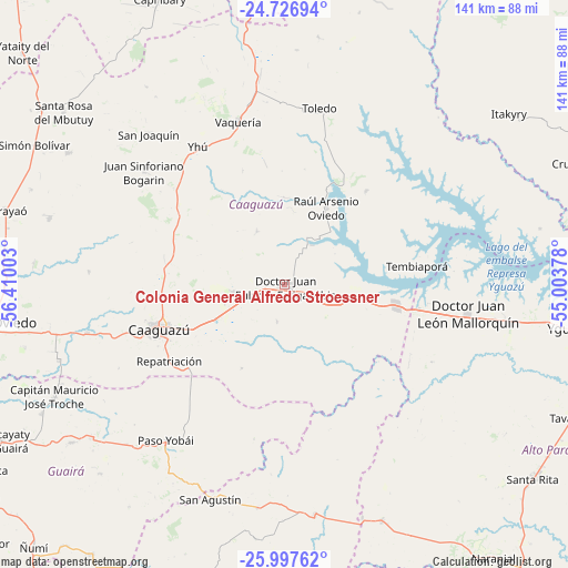
Colonia General Alfredo Stroessner GPS coordinates[2]
25° 21' 50.22" South, 55° 42' 24.84" West
| Map corner | latitude | longitude |
|---|---|---|
| Upper-left | -24.72694°, | -56.41003° |
| Center: | -25.36395°, | -55.7069° |
| Lower-right: | -25.99762°, | -55.00378° |
| Map W x H: | 141.3×141.3 km | = 87.8×87.8mi |
| max Lat: | -19.91667° ⇑39.5% North |
| Colonia General Alfredo Stroessner: | -25.36395° |
| min Lat: | ⇓60.5% South -27.38662° |
| min Long | Colonia General | max Long |
| -60.78333° | -55.7069° | -54.30694° |
| W 80.2%⇐ | ⇒19.8% E |
Elevation
Elevation of Colonia General Alfredo Stroessner is 308 m = 1010 ft, and this is 138.3 m = 454 ft above average elevation for this country.
| Max E: |
658 m = 2159 ft | 9.3% |
| Colonia General Alfredo Stroessner | 308 m 1010 ft | |
| Avg. | 169.7 m = 557 ft | |
Min E: |
46 m = 151 ft | 90.7% |
See also: Paraguay elevation on elevation.city.
Geographical zone
Colonia General Alfredo Stroessner is located in South temperate zone (between Tropic of Capricorn and the Antarctic Circle). Distance of this Southern Tropic circle is 214.3 km =133.2 mi to North.| Distance of | km | miles | from Colonia General Alfredo Stroessner |
|---|---|---|---|
| Equator | 2820.2 | 1752.4 | to North |
| Tropic Capricorn | 214.3 | 133.2 | to North |
| Antarctic Circle | 4581 | 2846.5 | to South |
| South Pole | 7186.9 | 4465.7 | to South |


Nearby cities:
15 places around Colonia General Alfredo Stroessner: (largest is in red/bold)
• Caaguazú
33.3 km =20.7 mi,  249°
249°
• Capiíbary
70.8 km =44 mi,  332°
332°
• Carayaó
72 km =44.7 mi,  284°
284°
• Cecilio Baez
63 km =39.1 mi,  301°
301°
• Colonia Mauricio José Troche
62.1 km =38.6 mi, 248°
• Doctor Juan León Mallorquín
46.1 km =28.6 mi,  99°
99°
• Doctor Juan Manuel Frutos
12.8 km =8 mi,  260°
260°
• General Higinio Morínigo
68.5 km =42.6 mi,  197°
197°
• Independencia
67 km =41.6 mi,  237°
237°
• Itakyry
70.1 km =43.6 mi,  53°
53°
• Natalicio Talavera
66.6 km =41.4 mi, 243°
• Repatriación
30.8 km =19.1 mi,  232°
232°
• San Joaquín
50.3 km =31.3 mi,  317°
317°
• Yguazú
71.8 km =44.6 mi, 98°
• Yhú
40.4 km =25.1 mi, 327°
Sources, notices
• [Note1] Compared only with cities in Paraguay existing in our database
• [Src1] Map data: © OpenStreetMap contributors (CC-BY-SA)
• [Src2] Other city data from geonames.org with taken over terms of usage.
• [Src3] Geographical zone / Annual Mean Temperature by Robert A. Rohde @ Wikipedia
