Teliucu Inferior geodata
Teliucu Inferior (Hunedoara) is a seat of a second-order administrative division; located in Romania in Europe/Bucharest (GMT+3) time zone. With population of 2,527 people, there are 2141 cities with bigger population in this country. Compared to other cities in Romania, 51.7% of cities are located further ↑North; 86.2% of cities are located further →East and 66.7% of cities have lower elevation than Teliucu Inferior. Note1


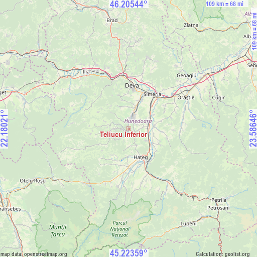
Teliucu Inferior GPS coordinates[2]
45° 43' 0.012" North, 22° 52' 59.988" East
| Map corner | latitude | longitude |
|---|---|---|
| Upper-left | 46.20544°, | 22.18021° |
| Center: | 45.71667°, | 22.88333° |
| Lower-right: | 45.22359°, | 23.58646° |
| Map W x H: | 109.2×109.2 km | = 67.9×67.9mi |
| max Lat: | 48.23793° ⇑51.7% North |
| Teliucu Inferior: | 45.71667° |
| min Lat: | ⇓48.3% South 43.65638° |
| min Long | Teliucu Inferio | max Long |
| 20.31667° | 22.88333° | 29.65403° |
| W 13.8%⇐ | ⇒86.2% E |
Elevation
Elevation of Teliucu Inferior is 300 m = 984 ft, and this is 45.1 m = 148 ft above average elevation for this country.
| Max E: |
1278 m = 4193 ft | 33.3% |
| Teliucu Inferior | 300 m 984 ft | |
| Avg. | 254.9 m = 836 ft | |
Min E: |
-2 m = -7 ft | 66.7% |
See also: Romania elevation on elevation.city.
Geographical zone
Teliucu Inferior is located in North temperate zone (between Tropic of Cancer and the Arctic Circle). Distance of this North polar circle is 2318 km =1440.3 mi to North.| Distance of | km | miles | from Teliucu Inferior |
|---|---|---|---|
| North Pole | 4923.8 | 3059.5 | to North |
| Arctic Circle | 2318 | 1440.3 | to North |
| Tropic Cancer | 2477.3 | 1539.3 | to South |
| Equator | 5083.2 | 3158.6 | to South |


Nearby cities:
15 places around Teliucu Inferior: (largest is in red/bold)
• Batiz
11.5 km =7.1 mi,  53°
53°
• Bretea Română
12.1 km =7.5 mi,  120°
120°
• Băcia
13.9 km =8.6 mi, 48°
• Cinciș-Cerna
1.8 km =1.1 mi,  157°
157°
• Cristur
13.4 km =8.3 mi,  20°
20°
• Călan
8 km =5 mi,  76°
76°
• General Berthelot
11.1 km =6.9 mi,  180°
180°
• Ghelari
7.8 km =4.8 mi,  270°
270°
• Haţeg
12.3 km =7.6 mi, 155°
• Hunedoara
3.9 km =2.4 mi, 19°
• Peştişu Mic
9.3 km =5.8 mi,  0°
0°
• Peștișu Mare
10.1 km =6.3 mi, 19°
• Răcăștia
5.7 km =3.5 mi,  352°
352°
• Streisângeorgiu
10.9 km =6.8 mi, 83°
• Topliţa
8.6 km =5.3 mi,  244°
244°
Sources, notices
• [Note1] Compared only with cities in Romania existing in our database
• [Src1] Map data: © OpenStreetMap contributors (CC-BY-SA)
• [Src2] Other city data from geonames.org with taken over terms of usage.
• [Src3] Geographical zone / Annual Mean Temperature by Robert A. Rohde @ Wikipedia
