Costești geodata
Costești (Iaşi) is a seat of a second-order administrative division; located in Romania in Europe/Bucharest (GMT+3) time zone. With population of 1,174 people, there are 3796 cities with bigger population in this country. Compared to other cities in Romania, 85.1% of cities are located further ↓South; 81.6% of cities are located further ←West and 62.5% of cities have higher elevation than Costești. Note1


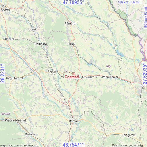
Costești GPS coordinates[2]
47° 14' 3.408" North, 26° 55' 34.392" East
| Map corner | latitude | longitude |
|---|---|---|
| Upper-left | 47.70955°, | 26.2231° |
| Center: | 47.23428°, | 26.92622° |
| Lower-right: | 46.75471°, | 27.62935° |
| Map W x H: | 106.2×106.2 km | = 66×66mi |
| max Lat: | 48.23793° ⇑14.9% North |
| Costești: | 47.23428° |
| min Lat: | ⇓85.1% South 43.65638° |
| min Long | Costești | max Long |
| 20.31667° | 26.92622° | 29.65403° |
| W 81.6%⇐ | ⇒18.4% E |
Elevation
Elevation of Costești is 157 m = 515 ft, and this is 97.9 m = 321 ft below average elevation for this country.
| Max E: |
1278 m = 4193 ft | 62.5% |
| Avg. | 254.9 m = 836 ft | |
| Costești | 157 m = 515 ft | |
Min E: |
-2 m = -7 ft | 37.5% |
See also: Romania elevation on elevation.city.
Geographical zone
Costești is located in North temperate zone (between Tropic of Cancer and the Arctic Circle). Distance of this North polar circle is 2149.2 km =1335.5 mi to North.| Distance of | km | miles | from Costești |
|---|---|---|---|
| North Pole | 4755.1 | 2954.7 | to North |
| Arctic Circle | 2149.2 | 1335.5 | to North |
| Tropic Cancer | 2646 | 1644.1 | to South |
| Equator | 5252 | 3263.4 | to South |


Nearby cities:
15 places around Costești: (largest is in red/bold)
• Balș
7.9 km =4.9 mi,  29°
29°
• Boureni
5.1 km =3.2 mi,  48°
48°
• Buznea
8 km =5 mi,  122°
122°
• Cucuteni
5.5 km =3.4 mi,  5°
5°
• Dumbrăvița
6.8 km =4.2 mi,  289°
289°
• Fărcășeni
8.6 km =5.3 mi,  195°
195°
• Giurgești
2.2 km =1.4 mi,  323°
323°
• Heleșteni
5.1 km =3.2 mi,  226°
226°
• Hărmăneasa
5.9 km =3.7 mi, 229°
• Oboroceni
7.4 km =4.6 mi,  209°
209°
• Rediu
4.7 km =2.9 mi,  278°
278°
• Ruginoasa
6 km =3.7 mi, 286°
• Războieni
9.6 km =6 mi,  101°
101°
• Strunga
8.7 km =5.4 mi,  150°
150°
• Târgu Frumos
6.8 km =4.2 mi, 124°
Sources, notices
• [Note1] Compared only with cities in Romania existing in our database
• [Src1] Map data: © OpenStreetMap contributors (CC-BY-SA)
• [Src2] Other city data from geonames.org with taken over terms of usage.
• [Src3] Geographical zone / Annual Mean Temperature by Robert A. Rohde @ Wikipedia
