Berghin geodata
Berghin (Alba) is a seat of a second-order administrative division; located in Romania in Europe/Bucharest (GMT+3) time zone. With population of 2,125 people, there are 2491 cities with bigger population in this country. Compared to other cities in Romania, 56.7% of cities are located further ↓South; 73.6% of cities are located further →East and 65.5% of cities have lower elevation than Berghin. Note1


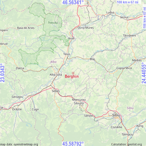
Berghin GPS coordinates[2]
46° 4' 40.152" North, 23° 44' 14.712" East
| Map corner | latitude | longitude |
|---|---|---|
| Upper-left | 46.56341°, | 23.0343° |
| Center: | 46.07782°, | 23.73742° |
| Lower-right: | 45.58792°, | 24.44055° |
| Map W x H: | 108.5×108.5 km | = 67.4×67.4mi |
| max Lat: | 48.23793° ⇑43.3% North |
| Berghin: | 46.07782° |
| min Lat: | ⇓56.7% South 43.65638° |
| min Long | Berghin | max Long |
| 20.31667° | 23.73742° | 29.65403° |
| W 26.4%⇐ | ⇒73.6% E |
Elevation
Elevation of Berghin is 293 m = 961 ft, and this is 38.1 m = 125 ft above average elevation for this country.
| Max E: |
1278 m = 4193 ft | 34.5% |
| Berghin | 293 m 961 ft | |
| Avg. | 254.9 m = 836 ft | |
Min E: |
-2 m = -7 ft | 65.5% |
See also: Romania elevation on elevation.city.
Geographical zone
Berghin is located in North temperate zone (between Tropic of Cancer and the Arctic Circle). Distance of this North polar circle is 2277.8 km =1415.4 mi to North.| Distance of | km | miles | from Berghin |
|---|---|---|---|
| North Pole | 4883.7 | 3034.6 | to North |
| Arctic Circle | 2277.8 | 1415.4 | to North |
| Tropic Cancer | 2517.5 | 1564.3 | to South |
| Equator | 5123.4 | 3183.5 | to South |


Nearby cities:
15 places around Berghin: (largest is in red/bold)
• Alba Iulia
12 km =7.5 mi,  264°
264°
• Bărăbanț
12 km =7.5 mi,  281°
281°
• Ciugud
9.8 km =6.1 mi,  251°
251°
• Daia Română
8.7 km =5.4 mi,  218°
218°
• Ghirbom
4.9 km =3 mi,  192°
192°
• Henig
3.1 km =1.9 mi,  350°
350°
• Mihalţ
8 km =5 mi,  357°
357°
• Obreja
11 km =6.8 mi,  11°
11°
• Ohaba
3.8 km =2.4 mi,  109°
109°
• Roşia de Secaş
11.7 km =7.3 mi, 105°
• Sântimbru
9.1 km =5.7 mi,  312°
312°
• Totoi
7.4 km =4.6 mi,  303°
303°
• Tău
8.1 km =5 mi,  95°
95°
• Vingard
7.2 km =4.5 mi,  174°
174°
• Șeușa
8.7 km =5.4 mi, 256°
Sources, notices
• [Note1] Compared only with cities in Romania existing in our database
• [Src1] Map data: © OpenStreetMap contributors (CC-BY-SA)
• [Src2] Other city data from geonames.org with taken over terms of usage.
• [Src3] Geographical zone / Annual Mean Temperature by Robert A. Rohde @ Wikipedia
