Zhigalovo geodata
Zhigalovo (Irkutsk Oblast) is a populated place; located in Russia in Asia/Irkutsk (GMT+8) time zone. With population of 5,272 people, there are 2520 cities with bigger population in this country. Compared to other cities in Russia, 51.3% of cities are located further ↓South; 89.8% of cities are located further ←West and 88.5% of cities have lower elevation than Zhigalovo. Note1


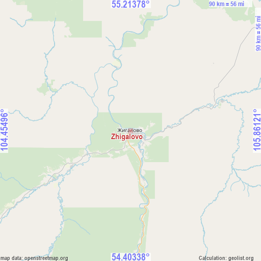
Zhigalovo GPS coordinates[2]
54° 48' 38.196" North, 105° 9' 29.088" East
| Map corner | latitude | longitude |
|---|---|---|
| Upper-left | 55.21378°, | 104.45496° |
| Center: | 54.81061°, | 105.15808° |
| Lower-right: | 54.40338°, | 105.86121° |
| Map W x H: | 90.1×90.1 km | = 56×56mi |
| max Lat: | 73.50819° ⇑48.7% North |
| Zhigalovo: | 54.81061° |
| min Lat: | ⇓51.3% South 41.28413° |
| min Long | Zhigalovo | max Long |
| -179.12198° | 105.15808° | 179.35046° |
| W 89.8%⇐ | ⇒10.2% E |
Elevation
Elevation of Zhigalovo is 412 m = 1352 ft, and this is 209.4 m = 687 ft above average elevation for this country.
| Max E: |
2518 m = 8261 ft | 11.5% |
| Zhigalovo | 412 m 1352 ft | |
| Avg. | 202.6 m = 665 ft | |
Min E: |
-28 m = -92 ft | 88.5% |
See also: Russia elevation on elevation.city.
Geographical zone
Zhigalovo is located in North temperate zone (between Tropic of Cancer and the Arctic Circle). Distance of this North polar circle is 1306.8 km =812 mi to North.| Distance of | km | miles | from Zhigalovo |
|---|---|---|---|
| North Pole | 3912.7 | 2431.2 | to North |
| Arctic Circle | 1306.8 | 812 | to North |
| Tropic Cancer | 3488.4 | 2167.6 | to South |
| Equator | 6094.4 | 3786.9 | to South |


Nearby cities:
15 places around Zhigalovo: (largest is in red/bold)
• Balagansk
163 km =101.3 mi,  236°
236°
• Bayanday
195.4 km =121.4 mi,  173°
173°
• Biryul’ka
129.6 km =80.5 mi,  143°
143°
• Bokhan
205.4 km =127.6 mi,  206°
206°
• Kachug
105.5 km =65.6 mi,  153°
153°
• Khrebtovaya
218 km =135.5 mi,  344°
344°
• Kimil’tey
218.6 km =135.8 mi,  249°
249°
• Magistral’nyy
208.8 km =129.7 mi,  43°
43°
• Manzurka
158.5 km =98.5 mi,  158°
158°
• Novonukutskiy
201.2 km =125 mi,  232°
232°
• Osa
178.9 km =111.2 mi, 207°
• Sayansk
208.6 km =129.6 mi, 248°
• Shestakovo
201.4 km =125.1 mi, 338°
• Ust’-Uda
154.5 km =96 mi, 242°
• Zheleznogorsk-Ilimskiy
206.8 km =128.5 mi, 341°
Sources, notices
• [Note1] Compared only with cities in Russia existing in our database
• [Src1] Map data: © OpenStreetMap contributors (CC-BY-SA)
• [Src2] Other city data from geonames.org with taken over terms of usage.
• [Src3] Geographical zone / Annual Mean Temperature by Robert A. Rohde @ Wikipedia
