Kachug geodata
Kachug (Irkutsk Oblast) is a populated place; located in Russia in Asia/Irkutsk (GMT+8) time zone. With population of 6,971 people, there are 2008 cities with bigger population in this country. Compared to other cities in Russia, 55.6% of cities are located further ↑North; 89.9% of cities are located further ←West and 92.2% of cities have lower elevation than Kachug. Note1


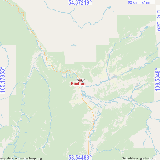
Kachug GPS coordinates[2]
53° 57' 38.016" North, 105° 52' 54.012" East
| Map corner | latitude | longitude |
|---|---|---|
| Upper-left | 54.37219°, | 105.17855° |
| Center: | 53.96056°, | 105.88167° |
| Lower-right: | 53.54483°, | 106.5848° |
| Map W x H: | 92×92 km | = 57.2×57.2mi |
| max Lat: | 73.50819° ⇑55.6% North |
| Kachug: | 53.96056° |
| min Lat: | ⇓44.4% South 41.28413° |
| min Long | Kachug | max Long |
| -179.12198° | 105.88167° | 179.35046° |
| W 89.9%⇐ | ⇒10.1% E |
Elevation
Elevation of Kachug is 515 m = 1690 ft, and this is 312.4 m = 1025 ft above average elevation for this country.
| Max E: |
2518 m = 8261 ft | 7.8% |
| Kachug | 515 m 1690 ft | |
| Avg. | 202.6 m = 665 ft | |
Min E: |
-28 m = -92 ft | 92.2% |
See also: Russia elevation on elevation.city.
Geographical zone
Kachug is located in North temperate zone (between Tropic of Cancer and the Arctic Circle). Distance of this North polar circle is 1401.3 km =870.7 mi to North.| Distance of | km | miles | from Kachug |
|---|---|---|---|
| North Pole | 4007.2 | 2490 | to North |
| Arctic Circle | 1401.3 | 870.7 | to North |
| Tropic Cancer | 3393.9 | 2108.9 | to South |
| Equator | 5999.9 | 3728.2 | to South |


Nearby cities:
15 places around Kachug: (largest is in red/bold)
• Balagansk
185 km =115 mi,  271°
271°
• Bayanday
102.4 km =63.6 mi,  193°
193°
• Biryul’ka
31.4 km =19.5 mi,  109°
109°
• Bokhan
165.8 km =103 mi,  237°
237°
• Bugul’deyka
157.8 km =98.1 mi,  175°
175°
• Khomutovo
193.2 km =120 mi,  210°
210°
• Khuzhir
128.6 km =79.9 mi,  131°
131°
• Manzurka
54 km =33.6 mi,  167°
167°
• Osa
146.6 km =91.1 mi, 244°
• Oyëk
179.8 km =111.7 mi, 211°
• Turka
191.4 km =118.9 mi, 125°
• Ust’-Ordynskiy
148.8 km =92.5 mi, 210°
• Ust’-Uda
187.5 km =116.5 mi,  277°
277°
• Yelantsy
133.3 km =82.8 mi,  164°
164°
• Zhigalovo
105.5 km =65.6 mi,  333°
333°
Sources, notices
• [Note1] Compared only with cities in Russia existing in our database
• [Src1] Map data: © OpenStreetMap contributors (CC-BY-SA)
• [Src2] Other city data from geonames.org with taken over terms of usage.
• [Src3] Geographical zone / Annual Mean Temperature by Robert A. Rohde @ Wikipedia
