Manzurka geodata
Manzurka (Irkutsk Oblast) is a populated place; located in Russia in Asia/Irkutsk (GMT+8) time zone. With population of 1,004 people, there are 4625 cities with bigger population in this country. Compared to other cities in Russia, 58.9% of cities are located further ↑North; 90% of cities are located further ←West and 94.2% of cities have lower elevation than Manzurka. Note1


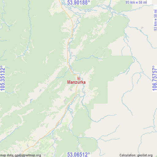
Manzurka GPS coordinates[2]
53° 29' 8.016" North, 106° 3' 15.984" East
| Map corner | latitude | longitude |
|---|---|---|
| Upper-left | 53.90188°, | 105.35132° |
| Center: | 53.48556°, | 106.05444° |
| Lower-right: | 53.06512°, | 106.75757° |
| Map W x H: | 93×93 km | = 57.8×57.8mi |
| max Lat: | 73.50819° ⇑58.9% North |
| Manzurka: | 53.48556° |
| min Lat: | ⇓41.1% South 41.28413° |
| min Long | Manzurka | max Long |
| -179.12198° | 106.05444° | 179.35046° |
| W 90%⇐ | ⇒10% E |
Elevation
Elevation of Manzurka is 593 m = 1946 ft, and this is 390.4 m = 1281 ft above average elevation for this country.
| Max E: |
2518 m = 8261 ft | 5.8% |
| Manzurka | 593 m 1946 ft | |
| Avg. | 202.6 m = 665 ft | |
Min E: |
-28 m = -92 ft | 94.2% |
See also: Russia elevation on elevation.city.
Geographical zone
Manzurka is located in North temperate zone (between Tropic of Cancer and the Arctic Circle). Distance of this North polar circle is 1454.1 km =903.5 mi to North.| Distance of | km | miles | from Manzurka |
|---|---|---|---|
| North Pole | 4060 | 2522.8 | to North |
| Arctic Circle | 1454.1 | 903.5 | to North |
| Tropic Cancer | 3341.1 | 2076.1 | to South |
| Equator | 5947 | 3695.3 | to South |


Nearby cities:
15 places around Manzurka: (largest is in red/bold)
• Bayanday
58.9 km =36.6 mi,  217°
217°
• Biryul’ka
46.3 km =28.8 mi,  23°
23°
• Bokhan
156.1 km =97 mi,  256°
256°
• Bugul’deyka
104.5 km =64.9 mi,  179°
179°
• Istok
155.1 km =96.4 mi, 175°
• Kachug
54 km =33.6 mi,  347°
347°
• Khomutovo
158.4 km =98.4 mi, 224°
• Khuzhir
91.3 km =56.7 mi,  110°
110°
• Osa
144.6 km =89.9 mi,  265°
265°
• Oyëk
146.4 km =91 mi,  226°
226°
• Posol’skoye
163 km =101.3 mi, 177°
• Turka
156.1 km =97 mi, 112°
• Ust’-Ordynskiy
115.3 km =71.6 mi, 228°
• Yelantsy
79.4 km =49.3 mi,  162°
162°
• Zhigalovo
158.5 km =98.5 mi,  338°
338°
Sources, notices
• [Note1] Compared only with cities in Russia existing in our database
• [Src1] Map data: © OpenStreetMap contributors (CC-BY-SA)
• [Src2] Other city data from geonames.org with taken over terms of usage.
• [Src3] Geographical zone / Annual Mean Temperature by Robert A. Rohde @ Wikipedia
