Markovo geodata
Markovo (Irkutsk Oblast) is a populated place; located in Russia in Asia/Irkutsk (GMT+8) time zone. With population of 6,340 people, there are 2168 cities with bigger population in this country. Compared to other cities in Russia, 79.2% of cities are located further ↓South; 90.3% of cities are located further ←West and 84.7% of cities have lower elevation than Markovo. Note1


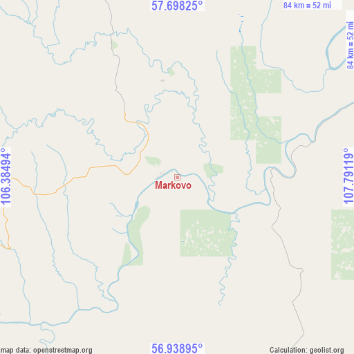
Markovo GPS coordinates[2]
57° 19' 14.016" North, 107° 5' 17.016" East
| Map corner | latitude | longitude |
|---|---|---|
| Upper-left | 57.69825°, | 106.38494° |
| Center: | 57.32056°, | 107.08806° |
| Lower-right: | 56.93895°, | 107.79119° |
| Map W x H: | 84.4×84.4 km | = 52.4×52.4mi |
| max Lat: | 73.50819° ⇑20.8% North |
| Markovo: | 57.32056° |
| min Lat: | ⇓79.2% South 41.28413° |
| min Long | Markovo | max Long |
| -179.12198° | 107.08806° | 179.35046° |
| W 90.3%⇐ | ⇒9.7% E |
Elevation
Elevation of Markovo is 315 m = 1033 ft, and this is 112.4 m = 369 ft above average elevation for this country.
| Max E: |
2518 m = 8261 ft | 15.3% |
| Markovo | 315 m 1033 ft | |
| Avg. | 202.6 m = 665 ft | |
Min E: |
-28 m = -92 ft | 84.7% |
See also: Russia elevation on elevation.city.
Geographical zone
Markovo is located in North temperate zone (between Tropic of Cancer and the Arctic Circle). Distance of this North polar circle is 1027.7 km =638.6 mi to North.| Distance of | km | miles | from Markovo |
|---|---|---|---|
| North Pole | 3633.6 | 2257.8 | to North |
| Arctic Circle | 1027.7 | 638.6 | to North |
| Tropic Cancer | 3767.5 | 2341 | to South |
| Equator | 6373.4 | 3960.2 | to South |


Nearby cities:
15 places around Markovo: (largest is in red/bold)
• Alekseyevskaya
97.9 km =60.8 mi,  53°
53°
• Bereznyaki
215.6 km =134 mi,  258°
258°
• Kazachinskoye
120.6 km =74.9 mi,  165°
165°
• Khrebtovaya
185 km =115 mi,  248°
248°
• Kirensk
80 km =49.7 mi, 49°
• Magistral’nyy
129.6 km =80.5 mi, 170°
• Nizhneangarsk
228.4 km =141.9 mi,  138°
138°
• Novaya Igirma
192.3 km =119.5 mi, 263°
• Rudnogorsk
200.5 km =124.6 mi,  268°
268°
• Severobaykal’sk
232.1 km =144.2 mi, 143°
• Shestakovo
211.1 km =131.2 mi,  244°
244°
• Ust’-Kut
99 km =61.5 mi,  233°
233°
• Yantal’
122.7 km =76.2 mi, 244°
• Zheleznogorsk-Ilimskiy
198 km =123 mi, 245°
• Zvëzdnyy
73.4 km =45.6 mi,  210°
210°
Sources, notices
• [Note1] Compared only with cities in Russia existing in our database
• [Src1] Map data: © OpenStreetMap contributors (CC-BY-SA)
• [Src2] Other city data from geonames.org with taken over terms of usage.
• [Src3] Geographical zone / Annual Mean Temperature by Robert A. Rohde @ Wikipedia
