Kazachinskoye geodata
Kazachinskoye (Irkutsk Oblast) is a populated place; located in Russia in Asia/Irkutsk (GMT+8) time zone. With population of 2,581 people, there are 3928 cities with bigger population in this country. Compared to other cities in Russia, 70.2% of cities are located further ↓South; 90.6% of cities are located further ←West and 86.4% of cities have lower elevation than Kazachinskoye. Note1


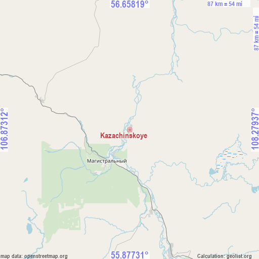
Kazachinskoye GPS coordinates[2]
56° 16' 11.064" North, 107° 34' 34.464" East
| Map corner | latitude | longitude |
|---|---|---|
| Upper-left | 56.65819°, | 106.87312° |
| Center: | 56.26974°, | 107.57624° |
| Lower-right: | 55.87731°, | 108.27937° |
| Map W x H: | 86.8×86.8 km | = 53.9×53.9mi |
| max Lat: | 73.50819° ⇑29.8% North |
| Kazachinskoye: | 56.26974° |
| min Lat: | ⇓70.2% South 41.28413° |
| min Long | Kazachinskoye | max Long |
| -179.12198° | 107.57624° | 179.35046° |
| W 90.6%⇐ | ⇒9.4% E |
Elevation
Elevation of Kazachinskoye is 354 m = 1161 ft, and this is 151.4 m = 497 ft above average elevation for this country.
| Max E: |
2518 m = 8261 ft | 13.6% |
| Kazachinskoye | 354 m 1161 ft | |
| Avg. | 202.6 m = 665 ft | |
Min E: |
-28 m = -92 ft | 86.4% |
See also: Russia elevation on elevation.city.
Geographical zone
Kazachinskoye is located in North temperate zone (between Tropic of Cancer and the Arctic Circle). Distance of this North polar circle is 1144.6 km =711.2 mi to North.| Distance of | km | miles | from Kazachinskoye |
|---|---|---|---|
| North Pole | 3750.5 | 2330.5 | to North |
| Arctic Circle | 1144.6 | 711.2 | to North |
| Tropic Cancer | 3650.7 | 2268.4 | to South |
| Equator | 6256.6 | 3887.7 | to South |


Nearby cities:
15 places around Kazachinskoye: (largest is in red/bold)
• Alekseyevskaya
182.6 km =113.5 mi,  15°
15°
• Khrebtovaya
209.8 km =130.4 mi,  283°
283°
• Kichera
160.8 km =99.9 mi,  103°
103°
• Kirensk
171.6 km =106.6 mi,  10°
10°
• Magistral’nyy
13.7 km =8.5 mi,  217°
217°
• Markovo
120.6 km =74.9 mi,  345°
345°
• Nizhneangarsk
135.3 km =84.1 mi,  113°
113°
• Novaya Igirma
243.4 km =151.2 mi,  293°
293°
• Severobaykal’sk
129.5 km =80.5 mi,  122°
122°
• Shestakovo
224 km =139.2 mi, 276°
• Ust’-Kut
125.3 km =77.9 mi,  297°
297°
• Yantal’
156.1 km =97 mi, 294°
• Zheleznogorsk-Ilimskiy
215.1 km =133.7 mi, 279°
• Zhigalovo
222.4 km =138.2 mi, 223°
• Zvëzdnyy
85.8 km =53.3 mi,  308°
308°
Sources, notices
• [Note1] Compared only with cities in Russia existing in our database
• [Src1] Map data: © OpenStreetMap contributors (CC-BY-SA)
• [Src2] Other city data from geonames.org with taken over terms of usage.
• [Src3] Geographical zone / Annual Mean Temperature by Robert A. Rohde @ Wikipedia
