Knyaze-Volkonskoye geodata
Knyaze-Volkonskoye (Khabarovsk) is a populated place; located in Russia in Asia/Vladivostok (GMT+10) time zone. With population of 8,936 people, there are 1667 cities with bigger population in this country. Compared to other cities in Russia, 79.9% of cities are located further ↑North; 97.1% of cities are located further ←West and 84% of cities have higher elevation than Knyaze-Volkonskoye. Note1


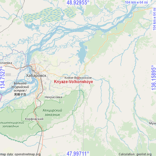
Knyaze-Volkonskoye GPS coordinates[2]
48° 27' 55.692" North, 135° 27' 20.952" East
| Map corner | latitude | longitude |
|---|---|---|
| Upper-left | 48.92955°, | 134.7527° |
| Center: | 48.46547°, | 135.45582° |
| Lower-right: | 47.99711°, | 136.15895° |
| Map W x H: | 103.7×103.7 km | = 64.4×64.4mi |
| max Lat: | 73.50819° ⇑79.9% North |
| Knyaze-Volkonskoye: | 48.46547° |
| min Lat: | ⇓20.1% South 41.28413° |
| min Long | Knyaze-Volkonsk | max Long |
| -179.12198° | 135.45582° | 179.35046° |
| W 97.1%⇐ | ⇒2.9% E |
Elevation
Elevation of Knyaze-Volkonskoye is 52 m = 171 ft, and this is 150.6 m = 494 ft below average elevation for this country.
| Max E: |
2518 m = 8261 ft | 84% |
| Avg. | 202.6 m = 665 ft | |
| Knyaze-Volkonskoye | 52 m = 171 ft | |
Min E: |
-28 m = -92 ft | 16% |
See also: Russia elevation on elevation.city.
Geographical zone
Knyaze-Volkonskoye is located in North temperate zone (between Tropic of Cancer and the Arctic Circle). Distance of this North polar circle is 2012.3 km =1250.4 mi to North.| Distance of | km | miles | from Knyaze-Volkonskoye |
|---|---|---|---|
| North Pole | 4618.2 | 2869.6 | to North |
| Arctic Circle | 2012.3 | 1250.4 | to North |
| Tropic Cancer | 2782.9 | 1729.2 | to South |
| Equator | 5388.9 | 3348.5 | to South |


Nearby cities:
15 places around Knyaze-Volkonskoye: (largest is in red/bold)
• Birobidzhan
189.6 km =117.8 mi,  281°
281°
• Khabarovsk
27.5 km =17.1 mi,  273°
273°
• Khabarovsk Vtoroy
24 km =14.9 mi,  262°
262°
• Khor
74.6 km =46.4 mi,  210°
210°
• Korfovskiy
39.8 km =24.7 mi,  227°
227°
• Lermontovka
168.7 km =104.8 mi, 209°
• Litovko
88.3 km =54.9 mi,  346°
346°
• Mukhen
57.9 km =36 mi,  121°
121°
• Nekrasovka
20.8 km =12.9 mi, 232°
• Priamurskiy
41.3 km =25.7 mi, 279°
• Sinda
83.2 km =51.7 mi,  48°
48°
• Smidovich
122.2 km =75.9 mi, 276°
• Topolëvo
21 km =13 mi, 281°
• Volochayevka Vtoraya
65.3 km =40.6 mi, 279°
• Vyazemskiy
115.6 km =71.8 mi, 206°
Sources, notices
• [Note1] Compared only with cities in Russia existing in our database
• [Src1] Map data: © OpenStreetMap contributors (CC-BY-SA)
• [Src2] Other city data from geonames.org with taken over terms of usage.
• [Src3] Geographical zone / Annual Mean Temperature by Robert A. Rohde @ Wikipedia
