Litovko geodata
Litovko (Khabarovsk) is a populated place; located in Russia in Asia/Vladivostok (GMT+10) time zone. With population of 2,670 people, there are 3901 cities with bigger population in this country. Compared to other cities in Russia, 78.7% of cities are located further ↑North; 97% of cities are located further ←West and 80% of cities have higher elevation than Litovko. Note1


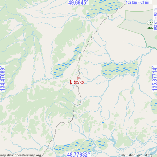
Litovko GPS coordinates[2]
49° 14' 15.144" North, 135° 10' 26.436" East
| Map corner | latitude | longitude |
|---|---|---|
| Upper-left | 49.6945°, | 134.47089° |
| Center: | 49.23754°, | 135.17401° |
| Lower-right: | 48.77632°, | 135.87714° |
| Map W x H: | 102.1×102.1 km | = 63.4×63.4mi |
| max Lat: | 73.50819° ⇑78.7% North |
| Litovko: | 49.23754° |
| min Lat: | ⇓21.3% South 41.28413° |
| min Long | Litovko | max Long |
| -179.12198° | 135.17401° | 179.35046° |
| W 97%⇐ | ⇒3% E |
Elevation
Elevation of Litovko is 71 m = 233 ft, and this is 131.6 m = 432 ft below average elevation for this country.
| Max E: |
2518 m = 8261 ft | 80% |
| Avg. | 202.6 m = 665 ft | |
| Litovko | 71 m = 233 ft | |
Min E: |
-28 m = -92 ft | 20% |
See also: Russia elevation on elevation.city.
Geographical zone
Litovko is located in North temperate zone (between Tropic of Cancer and the Arctic Circle). Distance of this North polar circle is 1926.5 km =1197.1 mi to North.| Distance of | km | miles | from Litovko |
|---|---|---|---|
| North Pole | 4532.4 | 2816.3 | to North |
| Arctic Circle | 1926.5 | 1197.1 | to North |
| Tropic Cancer | 2868.8 | 1782.6 | to South |
| Equator | 5474.7 | 3401.8 | to South |


Nearby cities:
15 places around Litovko: (largest is in red/bold)
• Amursk
165.5 km =102.8 mi,  47°
47°
• Birobidzhan
171.4 km =106.5 mi,  253°
253°
• Khabarovsk
84.2 km =52.3 mi,  184°
184°
• Khabarovsk Vtoroy
89 km =55.3 mi, 181°
• Khor
151.1 km =93.9 mi,  186°
186°
• Khurba
178.7 km =111 mi,  43°
43°
• Knyaze-Volkonskoye
88.3 km =54.9 mi,  166°
166°
• Korfovskiy
113.2 km =70.3 mi, 184°
• Mukhen
135.2 km =84 mi,  148°
148°
• Nekrasovka
98.5 km =61.2 mi, 177°
• Priamurskiy
81.4 km =50.6 mi, 194°
• Sinda
88 km =54.7 mi,  110°
110°
• Smidovich
122.6 km =76.2 mi,  234°
234°
• Topolëvo
81.7 km =50.8 mi, 179°
• Volochayevka Vtoraya
86.2 km =53.6 mi,  210°
210°
Sources, notices
• [Note1] Compared only with cities in Russia existing in our database
• [Src1] Map data: © OpenStreetMap contributors (CC-BY-SA)
• [Src2] Other city data from geonames.org with taken over terms of usage.
• [Src3] Geographical zone / Annual Mean Temperature by Robert A. Rohde @ Wikipedia
