Kamenskiy geodata
Kamenskiy (Saratovskaya Oblast) is a populated place; located in Russia in Europe/Saratov (GMT+4) time zone. With population of 3,617 people, there are 3323 cities with bigger population in this country. Compared to other cities in Russia, 75.3% of cities are located further ↑North; 51.5% of cities are located further ←West and 69% of cities have lower elevation than Kamenskiy. Note1


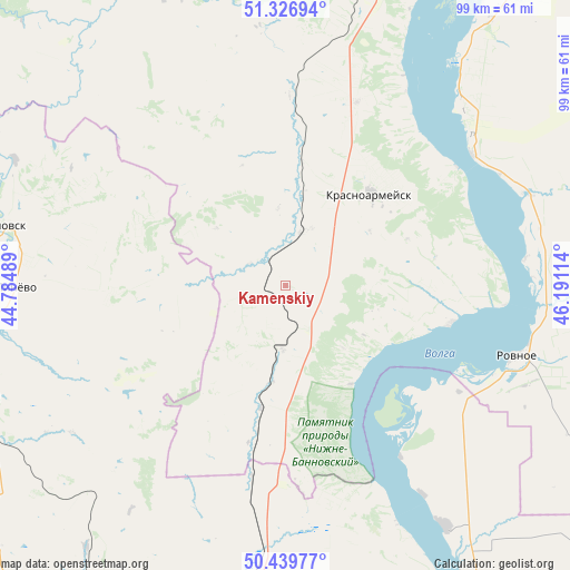
Kamenskiy GPS coordinates[2]
50° 53' 7.692" North, 45° 29' 16.836" East
| Map corner | latitude | longitude |
|---|---|---|
| Upper-left | 51.32694°, | 44.78489° |
| Center: | 50.88547°, | 45.48801° |
| Lower-right: | 50.43977°, | 46.19114° |
| Map W x H: | 98.6×98.6 km | = 61.3×61.3mi |
| max Lat: | 73.50819° ⇑75.3% North |
| Kamenskiy: | 50.88547° |
| min Lat: | ⇓24.7% South 41.28413° |
| min Long | Kamenskiy | max Long |
| -179.12198° | 45.48801° | 179.35046° |
| W 51.5%⇐ | ⇒48.5% E |
Elevation
Elevation of Kamenskiy is 194 m = 636 ft, and this is 8.6 m = 28 ft below average elevation for this country.
| Max E: |
2518 m = 8261 ft | 31% |
| Avg. | 202.6 m = 665 ft | |
| Kamenskiy | 194 m = 636 ft | |
Min E: |
-28 m = -92 ft | 69% |
See also: Russia elevation on elevation.city.
Geographical zone
Kamenskiy is located in North temperate zone (between Tropic of Cancer and the Arctic Circle). Distance of this North polar circle is 1743.2 km =1083.2 mi to North.| Distance of | km | miles | from Kamenskiy |
|---|---|---|---|
| North Pole | 4349.1 | 2702.4 | to North |
| Arctic Circle | 1743.2 | 1083.2 | to North |
| Tropic Cancer | 3052 | 1896.4 | to South |
| Equator | 5657.9 | 3515.7 | to South |


Nearby cities:
15 places around Kamenskiy: (largest is in red/bold)
• Engel’s
79.2 km =49.2 mi,  32°
32°
• Kotovo
79.3 km =49.3 mi,  217°
217°
• Krasnoarmeysk
21.2 km =13.2 mi,  43°
43°
• Krasnyy Oktyabr’
74.3 km =46.2 mi,  11°
11°
• Krasnyy Yar
57.4 km =35.7 mi,  248°
248°
• Lysyye Gory
86.6 km =53.8 mi,  328°
328°
• Medveditskiy
55.6 km =34.5 mi,  258°
258°
• Petrov Val
84.8 km =52.7 mi,  193°
193°
• Privolzhskiy
70.2 km =43.6 mi, 33°
• Rovnoye
41.3 km =25.7 mi,  107°
107°
• Rudnya
66 km =41 mi, 261°
• Saratov
81.4 km =50.6 mi, 26°
• Sokolovyy
79.7 km =49.5 mi,  17°
17°
• Staraya Poltavka
83.4 km =51.8 mi,  122°
122°
• Zhirnovsk
51.3 km =31.9 mi,  282°
282°
Sources, notices
• [Note1] Compared only with cities in Russia existing in our database
• [Src1] Map data: © OpenStreetMap contributors (CC-BY-SA)
• [Src2] Other city data from geonames.org with taken over terms of usage.
• [Src3] Geographical zone / Annual Mean Temperature by Robert A. Rohde @ Wikipedia
