Yelan’-Kolenovskiy geodata
Yelan’-Kolenovskiy (Voronezj) is a populated place; located in Russia in Europe/Moscow (GMT+3) time zone. With population of 4,112 people, there are 3048 cities with bigger population in this country. Compared to other cities in Russia, 74.1% of cities are located further ↑North; 62.4% of cities are located further →East and 71.5% of cities have higher elevation than Yelan’-Kolenovskiy. Note1


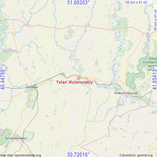
Yelan’-Kolenovskiy GPS coordinates[2]
51° 9' 47.52" North, 41° 9' 3.6" East
| Map corner | latitude | longitude |
|---|---|---|
| Upper-left | 51.60203°, | 40.44788° |
| Center: | 51.1632°, | 41.151° |
| Lower-right: | 50.72016°, | 41.85413° |
| Map W x H: | 98.1×98.1 km | = 61×61mi |
| max Lat: | 73.50819° ⇑74.1% North |
| Yelan’-Kolenovskiy: | 51.1632° |
| min Lat: | ⇓25.9% South 41.28413° |
| min Long | Yelan’-Koleno | max Long |
| -179.12198° | 41.151° | 179.35046° |
| W 37.6%⇐ | ⇒62.4% E |
Elevation
Elevation of Yelan’-Kolenovskiy is 99 m = 325 ft, and this is 103.6 m = 340 ft below average elevation for this country.
| Max E: |
2518 m = 8261 ft | 71.5% |
| Avg. | 202.6 m = 665 ft | |
| Yelan’-Kolenovskiy | 99 m = 325 ft | |
Min E: |
-28 m = -92 ft | 28.5% |
See also: Russia elevation on elevation.city.
Geographical zone
Yelan’-Kolenovskiy is located in North temperate zone (between Tropic of Cancer and the Arctic Circle). Distance of this North polar circle is 1712.4 km =1064 mi to North.| Distance of | km | miles | from Yelan’-Kolenovskiy |
|---|---|---|---|
| North Pole | 4318.2 | 2683.2 | to North |
| Arctic Circle | 1712.4 | 1064 | to North |
| Tropic Cancer | 3082.9 | 1915.6 | to South |
| Equator | 5688.8 | 3534.9 | to South |


Nearby cities:
15 places around Yelan’-Kolenovskiy: (largest is in red/bold)
• Abramovka
9.5 km =5.9 mi,  287°
287°
• Anna
61.5 km =38.2 mi,  305°
305°
• Buturlinovka
53.5 km =33.2 mi,  225°
225°
• Gribanovskiy
66.1 km =41.1 mi,  60°
60°
• Khrenovoye
60.3 km =37.5 mi,  265°
265°
• Kozlovka
59 km =36.7 mi,  235°
235°
• Muzhich’ye
46.5 km =28.9 mi,  186°
186°
• Novaya Chigla
47.4 km =29.5 mi,  278°
278°
• Novokhopërsk
33.9 km =21.1 mi,  102°
102°
• Sadovoye
60.9 km =37.8 mi, 312°
• Sloboda
59.3 km =36.8 mi, 267°
• Talovaya
29.9 km =18.6 mi,  259°
259°
• Verkhnyaya Tishanka
46.6 km =29 mi, 292°
• Vorob’yëvka
59 km =36.7 mi, 193°
• Yelan’-Koleno
5.7 km =3.5 mi, 102°
Sources, notices
• [Note1] Compared only with cities in Russia existing in our database
• [Src1] Map data: © OpenStreetMap contributors (CC-BY-SA)
• [Src2] Other city data from geonames.org with taken over terms of usage.
• [Src3] Geographical zone / Annual Mean Temperature by Robert A. Rohde @ Wikipedia
