Usogorsk geodata
Usogorsk (Komi) is a populated place; located in Russia in Europe/Moscow (GMT+3) time zone. With population of 5,308 people, there are 2505 cities with bigger population in this country. Compared to other cities in Russia, 96.5% of cities are located further ↓South; 60.4% of cities are located further ←West and 60.6% of cities have higher elevation than Usogorsk. Note1


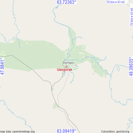
Usogorsk GPS coordinates[2]
63° 24' 38.304" North, 48° 41' 13.992" East
| Map corner | latitude | longitude |
|---|---|---|
| Upper-left | 63.72363°, | 47.9841° |
| Center: | 63.41064°, | 48.68722° |
| Lower-right: | 63.09419°, | 49.39035° |
| Map W x H: | 70×70 km | = 43.5×43.5mi |
| max Lat: | 73.50819° ⇑3.5% North |
| Usogorsk: | 63.41064° |
| min Lat: | ⇓96.5% South 41.28413° |
| min Long | Usogorsk | max Long |
| -179.12198° | 48.68722° | 179.35046° |
| W 60.4%⇐ | ⇒39.6% E |
Elevation
Elevation of Usogorsk is 123 m = 404 ft, and this is 79.6 m = 261 ft below average elevation for this country.
| Max E: |
2518 m = 8261 ft | 60.6% |
| Avg. | 202.6 m = 665 ft | |
| Usogorsk | 123 m = 404 ft | |
Min E: |
-28 m = -92 ft | 39.4% |
See also: Russia elevation on elevation.city.
Geographical zone
Usogorsk is located in North temperate zone (between Tropic of Cancer and the Arctic Circle). Distance of this North polar circle is 350.6 km =217.9 mi to North.| Distance of | km | miles | from Usogorsk |
|---|---|---|---|
| North Pole | 2956.5 | 1837.1 | to North |
| Arctic Circle | 350.6 | 217.9 | to North |
| Tropic Cancer | 4444.7 | 2761.8 | to South |
| Equator | 7050.6 | 4381 | to South |


Nearby cities:
15 places around Usogorsk: (largest is in red/bold)
• Aykino
147.6 km =91.7 mi,  153°
153°
• Blagoyevo
36 km =22.4 mi,  272°
272°
• Ezhva
206 km =128 mi, 149°
• Koslan
11.7 km =7.3 mi,  64°
64°
• Leshukonskoye
217.7 km =135.3 mi,  319°
319°
• Mezhdurechensk
19.5 km =12.1 mi,  200°
200°
• Mikun’
136.9 km =85.1 mi, 149°
• Sedkyrkeshch
217.1 km =134.9 mi, 148°
• Sindor
172.1 km =106.9 mi,  110°
110°
• Urdoma
184.4 km =114.6 mi,  182°
182°
• Ust’-Vym’
157.6 km =97.9 mi, 146°
• Yarensk
139.7 km =86.8 mi,  171°
171°
• Yemva
142.6 km =88.6 mi,  129°
129°
• Zelenets
199.7 km =124.1 mi, 148°
• Zheshart
155.4 km =96.6 mi,  163°
163°
Sources, notices
• [Note1] Compared only with cities in Russia existing in our database
• [Src1] Map data: © OpenStreetMap contributors (CC-BY-SA)
• [Src2] Other city data from geonames.org with taken over terms of usage.
• [Src3] Geographical zone / Annual Mean Temperature by Robert A. Rohde @ Wikipedia
