Aktyubinskiy geodata
Aktyubinskiy (Tatarstan Republic) is a populated place; located in Russia in Europe/Moscow (GMT+3) time zone. With population of 9,964 people, there are 1518 cities with bigger population in this country. Compared to other cities in Russia, 51.3% of cities are located further ↓South; 64.7% of cities are located further ←West and 84.2% of cities have lower elevation than Aktyubinskiy. Note1


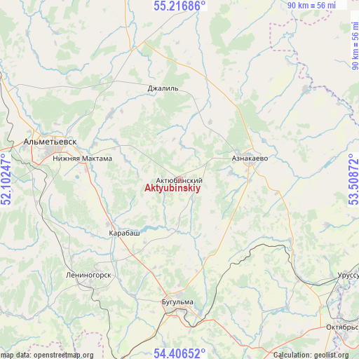
Aktyubinskiy GPS coordinates[2]
54° 48' 49.392" North, 52° 48' 20.124" East
| Map corner | latitude | longitude |
|---|---|---|
| Upper-left | 55.21686°, | 52.10247° |
| Center: | 54.81372°, | 52.80559° |
| Lower-right: | 54.40652°, | 53.50872° |
| Map W x H: | 90.1×90.1 km | = 56×56mi |
| max Lat: | 73.50819° ⇑48.7% North |
| Aktyubinskiy: | 54.81372° |
| min Lat: | ⇓51.3% South 41.28413° |
| min Long | Aktyubinskiy | max Long |
| -179.12198° | 52.80559° | 179.35046° |
| W 64.7%⇐ | ⇒35.3% E |
Elevation
Elevation of Aktyubinskiy is 307 m = 1007 ft, and this is 104.4 m = 343 ft above average elevation for this country.
| Max E: |
2518 m = 8261 ft | 15.8% |
| Aktyubinskiy | 307 m 1007 ft | |
| Avg. | 202.6 m = 665 ft | |
Min E: |
-28 m = -92 ft | 84.2% |
See also: Russia elevation on elevation.city.
Geographical zone
Aktyubinskiy is located in North temperate zone (between Tropic of Cancer and the Arctic Circle). Distance of this North polar circle is 1306.5 km =811.8 mi to North.| Distance of | km | miles | from Aktyubinskiy |
|---|---|---|---|
| North Pole | 3912.3 | 2431 | to North |
| Arctic Circle | 1306.5 | 811.8 | to North |
| Tropic Cancer | 3488.8 | 2167.8 | to South |
| Equator | 6094.7 | 3787.1 | to South |


Nearby cities:
15 places around Aktyubinskiy: (largest is in red/bold)
• Al’met’yevsk
33 km =20.5 mi,  287°
287°
• Bavly
55.2 km =34.3 mi,  147°
147°
• Bugul’ma
30.7 km =19.1 mi,  180°
180°
• Dzhalil’
23.8 km =14.8 mi,  349°
349°
• Karabash
19.6 km =12.2 mi,  226°
226°
• Leninogorsk
32.3 km =20.1 mi,  223°
223°
• Muslyumovo
59.8 km =37.2 mi,  24°
24°
• Nizhnyaya Maktama
24.8 km =15.4 mi,  282°
282°
• Oktyabr’skiy
56.5 km =35.1 mi,  130°
130°
• Russkiy Aktash
50.3 km =31.3 mi,  299°
299°
• Sarmanovo
51 km =31.7 mi,  344°
344°
• Shugurovo
55 km =34.2 mi, 231°
• Subkhankulovo
70.7 km =43.9 mi,  113°
113°
• Tuymazy
62.5 km =38.8 mi, 111°
• Urussu
48.6 km =30.2 mi,  119°
119°
Sources, notices
• [Note1] Compared only with cities in Russia existing in our database
• [Src1] Map data: © OpenStreetMap contributors (CC-BY-SA)
• [Src2] Other city data from geonames.org with taken over terms of usage.
• [Src3] Geographical zone / Annual Mean Temperature by Robert A. Rohde @ Wikipedia
