Pokrovskoye geodata
Pokrovskoye (Rostov) is a seat of a second-order administrative division; located in Russia in Europe/Moscow (GMT+3) time zone. With population of 12,576 people, there are 1230 cities with bigger population in this country. Compared to other cities in Russia, 81.4% of cities are located further ↑North; 72.7% of cities are located further →East and 92.9% of cities have higher elevation than Pokrovskoye. Note1


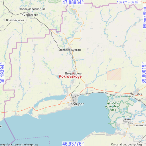
Pokrovskoye GPS coordinates[2]
47° 24' 56.52" North, 38° 53' 49.416" East
| Map corner | latitude | longitude |
|---|---|---|
| Upper-left | 47.88934°, | 38.19394° |
| Center: | 47.4157°, | 38.89706° |
| Lower-right: | 46.93776°, | 39.60019° |
| Map W x H: | 105.8×105.8 km | = 65.7×65.7mi |
| max Lat: | 73.50819° ⇑81.4% North |
| Pokrovskoye: | 47.4157° |
| min Lat: | ⇓18.6% South 41.28413° |
| min Long | Pokrovskoye | max Long |
| -179.12198° | 38.89706° | 179.35046° |
| W 27.3%⇐ | ⇒72.7% E |
Elevation
Elevation of Pokrovskoye is 18 m = 59 ft, and this is 184.6 m = 606 ft below average elevation for this country.
| Max E: |
2518 m = 8261 ft | 92.9% |
| Avg. | 202.6 m = 665 ft | |
| Pokrovskoye | 18 m = 59 ft | |
Min E: |
-28 m = -92 ft | 7.1% |
See also: Russia elevation on elevation.city.
Geographical zone
Pokrovskoye is located in North temperate zone (between Tropic of Cancer and the Arctic Circle). Distance of this North polar circle is 2129 km =1322.9 mi to North.| Distance of | km | miles | from Pokrovskoye |
|---|---|---|---|
| North Pole | 4734.9 | 2942.1 | to North |
| Arctic Circle | 2129 | 1322.9 | to North |
| Tropic Cancer | 2666.2 | 1656.7 | to South |
| Equator | 5272.1 | 3275.9 | to South |


Nearby cities:
15 places around Pokrovskoye: (largest is in red/bold)
• Anastasiyevka
32.1 km =19.9 mi,  300°
300°
• Azov
52 km =32.3 mi,  131°
131°
• Chaltyr
46.4 km =28.8 mi,  108°
108°
• Kalinin
49.9 km =31 mi, 112°
• Krym
48.4 km =30.1 mi, 105°
• Kuybyshevo
44.1 km =27.4 mi,  0°
0°
• Matveyev Kurgan
16.7 km =10.4 mi,  352°
352°
• Nedvigovka
37.8 km =23.5 mi,  115°
115°
• Novobessergenovka
26 km =16.2 mi,  188°
188°
• Persianovka
41.2 km =25.6 mi,  72°
72°
• Peshkovo
57.7 km =35.9 mi,  139°
139°
• Primorka
19.3 km =12 mi, 139°
• Sinyavskoye
32.6 km =20.3 mi, 118°
• Taganrog
20 km =12.4 mi,  180°
180°
• Tanais
36.8 km =22.9 mi, 116°
Sources, notices
• [Note1] Compared only with cities in Russia existing in our database
• [Src1] Map data: © OpenStreetMap contributors (CC-BY-SA)
• [Src2] Other city data from geonames.org with taken over terms of usage.
• [Src3] Geographical zone / Annual Mean Temperature by Robert A. Rohde @ Wikipedia
