Anastasiyevka geodata
Anastasiyevka (Rostov) is a populated place; located in Russia in Europe/Moscow (GMT+3) time zone. With population of 1,684 people, there are 4304 cities with bigger population in this country. Compared to other cities in Russia, 81.1% of cities are located further ↑North; 74.3% of cities are located further →East and 83.1% of cities have higher elevation than Anastasiyevka. Note1


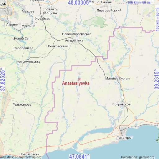
Anastasiyevka GPS coordinates[2]
47° 33' 38.592" North, 38° 31' 42.132" East
| Map corner | latitude | longitude |
|---|---|---|
| Upper-left | 48.03305°, | 37.82525° |
| Center: | 47.56072°, | 38.52837° |
| Lower-right: | 47.0841°, | 39.2315° |
| Map W x H: | 105.5×105.5 km | = 65.6×65.6mi |
| max Lat: | 73.50819° ⇑81.1% North |
| Anastasiyevka: | 47.56072° |
| min Lat: | ⇓18.9% South 41.28413° |
| min Long | Anastasiyevka | max Long |
| -179.12198° | 38.52837° | 179.35046° |
| W 25.7%⇐ | ⇒74.3% E |
Elevation
Elevation of Anastasiyevka is 57 m = 187 ft, and this is 145.6 m = 478 ft below average elevation for this country.
| Max E: |
2518 m = 8261 ft | 83.1% |
| Avg. | 202.6 m = 665 ft | |
| Anastasiyevka | 57 m = 187 ft | |
Min E: |
-28 m = -92 ft | 16.9% |
See also: Russia elevation on elevation.city.
Geographical zone
Anastasiyevka is located in North temperate zone (between Tropic of Cancer and the Arctic Circle). Distance of this North polar circle is 2112.9 km =1312.9 mi to North.| Distance of | km | miles | from Anastasiyevka |
|---|---|---|---|
| North Pole | 4718.8 | 2932.1 | to North |
| Arctic Circle | 2112.9 | 1312.9 | to North |
| Tropic Cancer | 2682.3 | 1666.7 | to South |
| Equator | 5288.3 | 3286 | to South |


Nearby cities:
15 places around Anastasiyevka: (largest is in red/bold)
• Chaltyr
78 km =48.5 mi,  113°
113°
• Kalinin
81.8 km =50.8 mi,  115°
115°
• Krym
79.8 km =49.6 mi, 111°
• Kuybyshevo
39.8 km =24.7 mi,  45°
45°
• Matveyev Kurgan
25.6 km =15.9 mi,  89°
89°
• Nedvigovka
69.7 km =43.3 mi, 117°
• Novobessergenovka
48.2 km =30 mi,  150°
150°
• Persianovka
66.9 km =41.6 mi, 92°
• Pokrovskoye
32.1 km =19.9 mi, 120°
• Port-Katon
77.7 km =48.3 mi,  167°
167°
• Primorka
50.7 km =31.5 mi,  127°
127°
• Shabel’skoye
78.8 km =49 mi,  183°
183°
• Sinyavskoye
64.7 km =40.2 mi, 119°
• Taganrog
45.5 km =28.3 mi,  142°
142°
• Tanais
68.8 km =42.8 mi, 118°
Sources, notices
• [Note1] Compared only with cities in Russia existing in our database
• [Src1] Map data: © OpenStreetMap contributors (CC-BY-SA)
• [Src2] Other city data from geonames.org with taken over terms of usage.
• [Src3] Geographical zone / Annual Mean Temperature by Robert A. Rohde @ Wikipedia
