Romanovskaya geodata
Romanovskaya (Rostov) is a seat of a second-order administrative division; located in Russia in Europe/Moscow (GMT+3) time zone. With population of 6,885 people, there are 2030 cities with bigger population in this country. Compared to other cities in Russia, 81.2% of cities are located further ↑North; 59.5% of cities are located further →East and 92.9% of cities have higher elevation than Romanovskaya. Note1


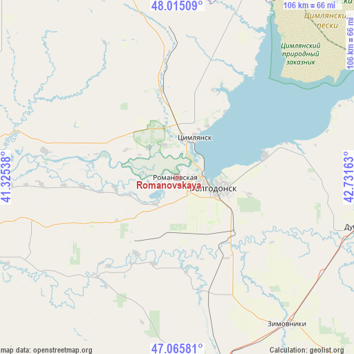
Romanovskaya GPS coordinates[2]
47° 32' 33.36" North, 42° 1' 42.6" East
| Map corner | latitude | longitude |
|---|---|---|
| Upper-left | 48.01509°, | 41.32538° |
| Center: | 47.5426°, | 42.0285° |
| Lower-right: | 47.06581°, | 42.73163° |
| Map W x H: | 105.6×105.5 km | = 65.6×65.6mi |
| max Lat: | 73.50819° ⇑81.2% North |
| Romanovskaya: | 47.5426° |
| min Lat: | ⇓18.8% South 41.28413° |
| min Long | Romanovskaya | max Long |
| -179.12198° | 42.0285° | 179.35046° |
| W 40.5%⇐ | ⇒59.5% E |
Elevation
Elevation of Romanovskaya is 18 m = 59 ft, and this is 184.6 m = 606 ft below average elevation for this country.
| Max E: |
2518 m = 8261 ft | 92.9% |
| Avg. | 202.6 m = 665 ft | |
| Romanovskaya | 18 m = 59 ft | |
Min E: |
-28 m = -92 ft | 7.1% |
See also: Russia elevation on elevation.city.
Geographical zone
Romanovskaya is located in North temperate zone (between Tropic of Cancer and the Arctic Circle). Distance of this North polar circle is 2114.9 km =1314.1 mi to North.| Distance of | km | miles | from Romanovskaya |
|---|---|---|---|
| North Pole | 4720.8 | 2933.4 | to North |
| Arctic Circle | 2114.9 | 1314.1 | to North |
| Tropic Cancer | 2680.3 | 1665.5 | to South |
| Equator | 5286.2 | 3284.7 | to South |


Nearby cities:
15 places around Romanovskaya: (largest is in red/bold)
• Bol’shaya Martynovka
40.4 km =25.1 mi,  222°
222°
• Dubovskoye
57.5 km =35.7 mi,  104°
104°
• Gundorovskiy
85.3 km =53 mi,  186°
186°
• Konstantinovsk
70.4 km =43.7 mi,  273°
273°
• Kotel’nikovo
84 km =52.2 mi,  83°
83°
• Krasnoarmeyskiy
60.6 km =37.7 mi,  167°
167°
• Krasnoyarskaya
12 km =7.5 mi,  5°
5°
• Krasnoyarskaya
12.9 km =8 mi,  113°
113°
• Morozovsk
91.6 km =56.9 mi,  350°
350°
• Nikolayevskaya
40.3 km =25 mi,  281°
281°
• Orlovskiy
74.7 km =46.4 mi,  178°
178°
• Tsimlyansk
12.8 km =8 mi,  25°
25°
• Ust’-Donetskiy
87.4 km =54.3 mi, 277°
• Volgodonsk
9.8 km =6.1 mi, 109°
• Zimovniki
55.2 km =34.3 mi,  142°
142°
Sources, notices
• [Note1] Compared only with cities in Russia existing in our database
• [Src1] Map data: © OpenStreetMap contributors (CC-BY-SA)
• [Src2] Other city data from geonames.org with taken over terms of usage.
• [Src3] Geographical zone / Annual Mean Temperature by Robert A. Rohde @ Wikipedia
