Tsimlyansk geodata
Tsimlyansk (Rostov) is a seat of a second-order administrative division; located in Russia in Europe/Moscow (GMT+3) time zone. With population of 15,341 people, there are 1071 cities with bigger population in this country. Compared to other cities in Russia, 80.9% of cities are located further ↑North; 59.3% of cities are located further →East and 76.7% of cities have higher elevation than Tsimlyansk. Note1


Tsimlyansk GPS coordinates[2]
47° 38' 45.996" North, 42° 6' 6.984" East
| Map corner | latitude | longitude |
|---|---|---|
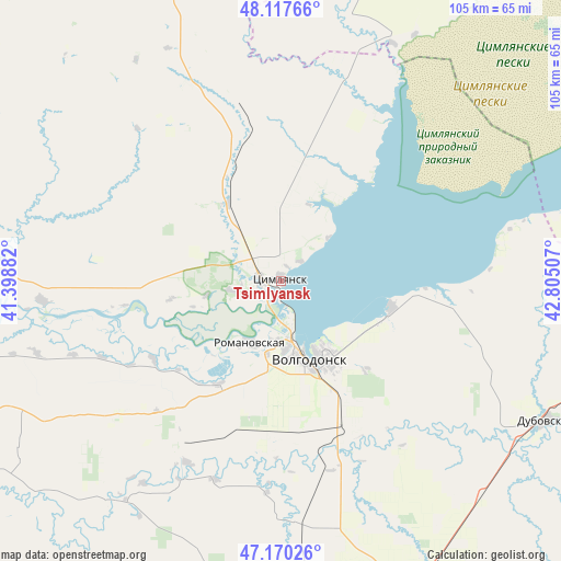
| Upper-left | 48.11766°, | 41.39882° |
| Center: | 47.64611°, | 42.10194° |
| Lower-right: | 47.17026°, | 42.80507° |
| Map W x H: | 105.3×105.3 km | = 65.4×65.4mi |
| max Lat: | 73.50819° ⇑80.9% North |
| Tsimlyansk: | 47.64611° |
| min Lat: | ⇓19.1% South 41.28413° |
| min Long | Tsimlyansk | max Long |
| -179.12198° | 42.10194° | 179.35046° |
| W 40.7%⇐ | ⇒59.3% E |
Elevation
Elevation of Tsimlyansk is 82 m = 269 ft, and this is 120.6 m = 396 ft below average elevation for this country.
| Max E: |
2518 m = 8261 ft | 76.7% |
| Avg. | 202.6 m = 665 ft | |
| Tsimlyansk | 82 m = 269 ft | |
Min E: |
-28 m = -92 ft | 23.3% |
See also: Russia elevation on elevation.city.
Geographical zone
Tsimlyansk is located in North temperate zone (between Tropic of Cancer and the Arctic Circle). Distance of this North polar circle is 2103.4 km =1307 mi to North.| Distance of | km | miles | from Tsimlyansk |
|---|---|---|---|
| North Pole | 4709.3 | 2926.2 | to North |
| Arctic Circle | 2103.4 | 1307 | to North |
| Tropic Cancer | 2691.8 | 1672.6 | to South |
| Equator | 5297.8 | 3291.9 | to South |


Nearby cities:
15 places around Tsimlyansk: (largest is in red/bold)
• Bol’shaya Martynovka
52.7 km =32.7 mi,  218°
218°
• Chernyshkovskiy
86.8 km =53.9 mi,  6°
6°
• Dubovskoye
56.4 km =35 mi,  117°
117°
• Konstantinovsk
76 km =47.2 mi,  264°
264°
• Kotel’nikovo
77.8 km =48.3 mi,  91°
91°
• Krasnoarmeyskiy
71 km =44.1 mi,  173°
173°
• Krasnoyarskaya
4.3 km =2.7 mi,  275°
275°
• Krasnoyarskaya
17.9 km =11.1 mi,  159°
159°
• Morozovsk
81.4 km =50.6 mi,  345°
345°
• Nikolayevskaya
45.1 km =28 mi,  265°
265°
• Orlovskiy
86.2 km =53.6 mi,  182°
182°
• Romanovskaya
12.8 km =8 mi,  205°
205°
• Tatsinskiy
86.8 km =53.9 mi,  314°
314°
• Volgodonsk
15.2 km =9.4 mi, 165°
• Zimovniki
62.1 km =38.6 mi,  153°
153°
Sources, notices
• [Note1] Compared only with cities in Russia existing in our database
• [Src1] Map data: © OpenStreetMap contributors (CC-BY-SA)
• [Src2] Other city data from geonames.org with taken over terms of usage.
• [Src3] Geographical zone / Annual Mean Temperature by Robert A. Rohde @ Wikipedia
