Chelno-Vershiny geodata
Chelno-Vershiny (Samara Oblast) is a populated place; located in Russia in Europe/Samara (GMT+4) time zone. With population of 6,015 people, there are 2254 cities with bigger population in this country. Compared to other cities in Russia, 51.8% of cities are located further ↑North; 63.1% of cities are located further ←West and 50.4% of cities have lower elevation than Chelno-Vershiny. Note1


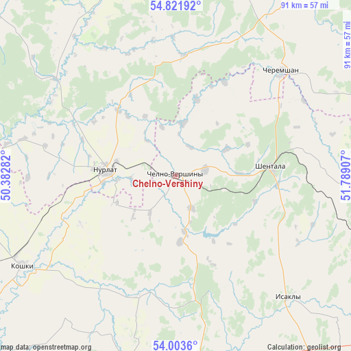
Chelno-Vershiny GPS coordinates[2]
54° 24' 53.28" North, 51° 5' 9.384" East
| Map corner | latitude | longitude |
|---|---|---|
| Upper-left | 54.82192°, | 50.38282° |
| Center: | 54.4148°, | 51.08594° |
| Lower-right: | 54.0036°, | 51.78907° |
| Map W x H: | 91×91 km | = 56.5×56.5mi |
| max Lat: | 73.50819° ⇑51.8% North |
| Chelno-Vershiny: | 54.4148° |
| min Lat: | ⇓48.2% South 41.28413° |
| min Long | Chelno-Vershiny | max Long |
| -179.12198° | 51.08594° | 179.35046° |
| W 63.1%⇐ | ⇒36.9% E |
Elevation
Elevation of Chelno-Vershiny is 145 m = 476 ft, and this is 57.6 m = 189 ft below average elevation for this country.
| Max E: |
2518 m = 8261 ft | 49.6% |
| Avg. | 202.6 m = 665 ft | |
| Chelno-Vershiny | 145 m = 476 ft | |
Min E: |
-28 m = -92 ft | 50.4% |
See also: Russia elevation on elevation.city.
Geographical zone
Chelno-Vershiny is located in North temperate zone (between Tropic of Cancer and the Arctic Circle). Distance of this North polar circle is 1350.8 km =839.3 mi to North.| Distance of | km | miles | from Chelno-Vershiny |
|---|---|---|---|
| North Pole | 3956.7 | 2458.6 | to North |
| Arctic Circle | 1350.8 | 839.3 | to North |
| Tropic Cancer | 3444.4 | 2140.3 | to South |
| Equator | 6050.4 | 3759.5 | to South |


Nearby cities:
15 places around Chelno-Vershiny: (largest is in red/bold)
• Bilyarsk
77.6 km =48.2 mi,  324°
324°
• Cheremshan
38.7 km =24 mi,  43°
43°
• Isakly
42.7 km =26.5 mi,  137°
137°
• Kamyshla
76.2 km =47.3 mi,  115°
115°
• Klyavlino
63.2 km =39.3 mi,  105°
105°
• Koshki
46.2 km =28.7 mi,  240°
240°
• Novaya Malykla
77.5 km =48.2 mi,  252°
252°
• Novocheremshansk
59.9 km =37.2 mi,  263°
263°
• Novosheshminsk
72.9 km =45.3 mi,  7°
7°
• Nurlat
18.2 km =11.3 mi,  274°
274°
• Sernovodsk
55.8 km =34.7 mi,  168°
168°
• Shentala
26 km =16.2 mi,  81°
81°
• Shugurovo
68.4 km =42.5 mi, 81°
• Sukhodol
57.8 km =35.9 mi, 171°
• Surgut
55 km =34.2 mi, 172°
Sources, notices
• [Note1] Compared only with cities in Russia existing in our database
• [Src1] Map data: © OpenStreetMap contributors (CC-BY-SA)
• [Src2] Other city data from geonames.org with taken over terms of usage.
• [Src3] Geographical zone / Annual Mean Temperature by Robert A. Rohde @ Wikipedia
