Nurlat geodata
Nurlat (Tatarstan Republic) is a populated place; located in Russia in Europe/Moscow (GMT+3) time zone. With population of 34,451 people, there are 584 cities with bigger population in this country. Compared to other cities in Russia, 51.6% of cities are located further ↑North; 62.9% of cities are located further ←West and 54.9% of cities have lower elevation than Nurlat. Note1


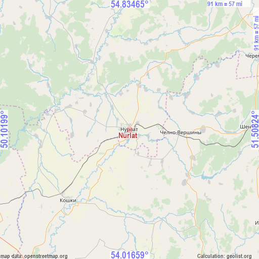
Nurlat GPS coordinates[2]
54° 25' 39.576" North, 50° 48' 18.396" East
| Map corner | latitude | longitude |
|---|---|---|
| Upper-left | 54.83465°, | 50.10199° |
| Center: | 54.42766°, | 50.80511° |
| Lower-right: | 54.01659°, | 51.50824° |
| Map W x H: | 91×91 km | = 56.5×56.5mi |
| max Lat: | 73.50819° ⇑51.6% North |
| Nurlat: | 54.42766° |
| min Lat: | ⇓48.4% South 41.28413° |
| min Long | Nurlat | max Long |
| -179.12198° | 50.80511° | 179.35046° |
| W 62.9%⇐ | ⇒37.1% E |
Elevation
Elevation of Nurlat is 156 m = 512 ft, and this is 46.6 m = 153 ft below average elevation for this country.
| Max E: |
2518 m = 8261 ft | 45.1% |
| Avg. | 202.6 m = 665 ft | |
| Nurlat | 156 m = 512 ft | |
Min E: |
-28 m = -92 ft | 54.9% |
See also: Russia elevation on elevation.city.
Geographical zone
Nurlat is located in North temperate zone (between Tropic of Cancer and the Arctic Circle). Distance of this North polar circle is 1349.4 km =838.5 mi to North.| Distance of | km | miles | from Nurlat |
|---|---|---|---|
| North Pole | 3955.3 | 2457.7 | to North |
| Arctic Circle | 1349.4 | 838.5 | to North |
| Tropic Cancer | 3445.9 | 2141.2 | to South |
| Equator | 6051.8 | 3760.4 | to South |


Nearby cities:
15 places around Nurlat: (largest is in red/bold)
• Bazarnyye Mataki
75.6 km =47 mi,  312°
312°
• Bilyarsk
67.4 km =41.9 mi,  336°
336°
• Chelno-Vershiny
18.2 km =11.3 mi,  94°
94°
• Cheremshan
52.1 km =32.4 mi,  59°
59°
• Isakly
57.5 km =35.7 mi,  124°
124°
• Koshki
32.7 km =20.3 mi,  222°
222°
• Novaya Malykla
61 km =37.9 mi,  245°
245°
• Novaya Mayna
75.1 km =46.7 mi, 245°
• Novocheremshansk
42.1 km =26.2 mi,  259°
259°
• Novosheshminsk
76 km =47.2 mi,  21°
21°
• Sernovodsk
63.4 km =39.4 mi,  152°
152°
• Shentala
43.9 km =27.3 mi, 86°
• Sukhodol
64.3 km =40 mi,  155°
155°
• Surgut
61.6 km =38.3 mi, 155°
• Yelkhovka
71 km =44.1 mi,  208°
208°
Sources, notices
• [Note1] Compared only with cities in Russia existing in our database
• [Src1] Map data: © OpenStreetMap contributors (CC-BY-SA)
• [Src2] Other city data from geonames.org with taken over terms of usage.
• [Src3] Geographical zone / Annual Mean Temperature by Robert A. Rohde @ Wikipedia
