Bilyarsk geodata
Bilyarsk (Tatarstan Republic) is a populated place; located in Russia in Europe/Moscow (GMT+3) time zone. With population of 2,179 people, there are 4082 cities with bigger population in this country. Compared to other cities in Russia, 53.1% of cities are located further ↓South; 62.5% of cities are located further ←West and 68.2% of cities have higher elevation than Bilyarsk. Note1


Bilyarsk GPS coordinates[2]
54° 59' 0.888" North, 50° 23' 12.156" East
| Map corner | latitude | longitude |
|---|---|---|
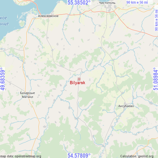
| Upper-left | 55.38502°, | 49.68359° |
| Center: | 54.98358°, | 50.38671° |
| Lower-right: | 54.57809°, | 51.08984° |
| Map W x H: | 89.7×89.7 km | = 55.7×55.7mi |
| max Lat: | 73.50819° ⇑46.9% North |
| Bilyarsk: | 54.98358° |
| min Lat: | ⇓53.1% South 41.28413° |
| min Long | Bilyarsk | max Long |
| -179.12198° | 50.38671° | 179.35046° |
| W 62.5%⇐ | ⇒37.5% E |
Elevation
Elevation of Bilyarsk is 107 m = 351 ft, and this is 95.6 m = 314 ft below average elevation for this country.
| Max E: |
2518 m = 8261 ft | 68.2% |
| Avg. | 202.6 m = 665 ft | |
| Bilyarsk | 107 m = 351 ft | |
Min E: |
-28 m = -92 ft | 31.8% |
See also: Russia elevation on elevation.city.
Geographical zone
Bilyarsk is located in North temperate zone (between Tropic of Cancer and the Arctic Circle). Distance of this North polar circle is 1287.6 km =800.1 mi to North.| Distance of | km | miles | from Bilyarsk |
|---|---|---|---|
| North Pole | 3893.5 | 2419.3 | to North |
| Arctic Circle | 1287.6 | 800.1 | to North |
| Tropic Cancer | 3507.7 | 2179.6 | to South |
| Equator | 6113.6 | 3798.8 | to South |


Nearby cities:
15 places around Bilyarsk: (largest is in red/bold)
• Alekseyevskoye
39.9 km =24.8 mi,  334°
334°
• Bazarnyye Mataki
31 km =19.3 mi,  248°
248°
• Bolgar
84.3 km =52.4 mi,  267°
267°
• Chelno-Vershiny
77.6 km =48.2 mi,  144°
144°
• Cheremshan
79.5 km =49.4 mi,  116°
116°
• Chistopol’
45.2 km =28.1 mi,  21°
21°
• Koshki
86.3 km =53.6 mi,  176°
176°
• Kuybyshevskiy Zaton
79.9 km =49.6 mi,  284°
284°
• Laishevo
70.8 km =44 mi,  311°
311°
• Novaya Malykla
91.6 km =56.9 mi,  197°
197°
• Novocheremshansk
71.1 km =44.2 mi,  191°
191°
• Novosheshminsk
54.7 km =34 mi,  80°
80°
• Nurlat
67.4 km =41.9 mi,  156°
156°
• Rybnaya Sloboda
55.4 km =34.4 mi,  343°
343°
• Shentala
92.1 km =57.2 mi,  130°
130°
Sources, notices
• [Note1] Compared only with cities in Russia existing in our database
• [Src1] Map data: © OpenStreetMap contributors (CC-BY-SA)
• [Src2] Other city data from geonames.org with taken over terms of usage.
• [Src3] Geographical zone / Annual Mean Temperature by Robert A. Rohde @ Wikipedia
