Cheremshan geodata
Cheremshan (Tatarstan Republic) is a populated place; located in Russia in Europe/Moscow (GMT+3) time zone. With population of 5,646 people, there are 2383 cities with bigger population in this country. Compared to other cities in Russia, 50.2% of cities are located further ↓South; 63.5% of cities are located further ←West and 52.6% of cities have higher elevation than Cheremshan. Note1


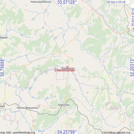
Cheremshan GPS coordinates[2]
54° 40' 0.012" North, 51° 30' 0" East
| Map corner | latitude | longitude |
|---|---|---|
| Upper-left | 55.07128°, | 50.79688° |
| Center: | 54.66667°, | 51.5° |
| Lower-right: | 54.25799°, | 52.20313° |
| Map W x H: | 90.4×90.4 km | = 56.2×56.2mi |
| max Lat: | 73.50819° ⇑49.8% North |
| Cheremshan: | 54.66667° |
| min Lat: | ⇓50.2% South 41.28413° |
| min Long | Cheremshan | max Long |
| -179.12198° | 51.5° | 179.35046° |
| W 63.5%⇐ | ⇒36.5% E |
Elevation
Elevation of Cheremshan is 139 m = 456 ft, and this is 63.6 m = 209 ft below average elevation for this country.
| Max E: |
2518 m = 8261 ft | 52.6% |
| Avg. | 202.6 m = 665 ft | |
| Cheremshan | 139 m = 456 ft | |
Min E: |
-28 m = -92 ft | 47.4% |
See also: Russia elevation on elevation.city.
Geographical zone
Cheremshan is located in North temperate zone (between Tropic of Cancer and the Arctic Circle). Distance of this North polar circle is 1322.8 km =821.9 mi to North.| Distance of | km | miles | from Cheremshan |
|---|---|---|---|
| North Pole | 3928.7 | 2441.2 | to North |
| Arctic Circle | 1322.8 | 821.9 | to North |
| Tropic Cancer | 3472.4 | 2157.6 | to South |
| Equator | 6078.4 | 3776.9 | to South |


Nearby cities:
15 places around Cheremshan: (largest is in red/bold)
• Al’met’yevsk
58.6 km =36.4 mi,  63°
63°
• Bilyarsk
79.5 km =49.4 mi,  296°
296°
• Chelno-Vershiny
38.7 km =24 mi,  223°
223°
• Isakly
59.3 km =36.8 mi,  177°
177°
• Kamyshla
73.9 km =45.9 mi,  145°
145°
• Karabash
69.7 km =43.3 mi,  87°
87°
• Klyavlino
56.2 km =34.9 mi,  142°
142°
• Leninogorsk
62.2 km =38.6 mi,  96°
96°
• Nizhnyaya Maktama
63.4 km =39.4 mi,  69°
69°
• Novosheshminsk
47.5 km =29.5 mi,  338°
338°
• Nurlat
52.1 km =32.4 mi,  239°
239°
• Russkiy Aktash
57.4 km =35.7 mi,  43°
43°
• Shentala
24.1 km =15 mi, 182°
• Shugurovo
44.4 km =27.6 mi,  113°
113°
• Zainsk
81.2 km =50.5 mi,  26°
26°
Sources, notices
• [Note1] Compared only with cities in Russia existing in our database
• [Src1] Map data: © OpenStreetMap contributors (CC-BY-SA)
• [Src2] Other city data from geonames.org with taken over terms of usage.
• [Src3] Geographical zone / Annual Mean Temperature by Robert A. Rohde @ Wikipedia
