Veseloyarsk geodata
Veseloyarsk (Altai Krai) is a populated place; located in Russia in Asia/Barnaul (GMT+7) time zone. With population of 5,230 people, there are 2543 cities with bigger population in this country. Compared to other cities in Russia, 73.6% of cities are located further ↑North; 79.6% of cities are located further ←West and 77.7% of cities have lower elevation than Veseloyarsk. Note1


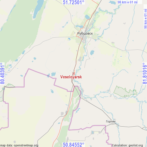
Veseloyarsk GPS coordinates[2]
51° 17' 14.532" North, 81° 6' 25.308" East
| Map corner | latitude | longitude |
|---|---|---|
| Upper-left | 51.72501°, | 80.40391° |
| Center: | 51.28737°, | 81.10703° |
| Lower-right: | 50.84552°, | 81.81016° |
| Map W x H: | 97.8×97.8 km | = 60.8×60.8mi |
| max Lat: | 73.50819° ⇑73.6% North |
| Veseloyarsk: | 51.28737° |
| min Lat: | ⇓26.4% South 41.28413° |
| min Long | Veseloyarsk | max Long |
| -179.12198° | 81.10703° | 179.35046° |
| W 79.6%⇐ | ⇒20.4% E |
Elevation
Elevation of Veseloyarsk is 231 m = 758 ft, and this is 28.4 m = 93 ft above average elevation for this country.
| Max E: |
2518 m = 8261 ft | 22.3% |
| Veseloyarsk | 231 m 758 ft | |
| Avg. | 202.6 m = 665 ft | |
Min E: |
-28 m = -92 ft | 77.7% |
See also: Russia elevation on elevation.city.
Geographical zone
Veseloyarsk is located in North temperate zone (between Tropic of Cancer and the Arctic Circle). Distance of this North polar circle is 1698.6 km =1055.5 mi to North.| Distance of | km | miles | from Veseloyarsk |
|---|---|---|---|
| North Pole | 4304.4 | 2674.6 | to North |
| Arctic Circle | 1698.6 | 1055.5 | to North |
| Tropic Cancer | 3096.7 | 1924.2 | to South |
| Equator | 5702.6 | 3543.4 | to South |


Nearby cities:
15 places around Veseloyarsk: (largest is in red/bold)
• Bastan
129.5 km =80.5 mi,  299°
299°
• Gornyak
41.1 km =25.5 mi,  142°
142°
• Krasnoshchekovo
120.1 km =74.6 mi,  69°
69°
• Malinovoye Ozero
101.4 km =63 mi, 295°
• Mikhaylovskoye
113.1 km =70.3 mi, 301°
• Nikolayevka
136.6 km =84.9 mi, 301°
• Novichikha
103.7 km =64.4 mi,  10°
10°
• Pospelikha
86.6 km =53.8 mi,  31°
31°
• Romanovo
148.2 km =92.1 mi,  3°
3°
• Rubtsovsk
26.2 km =16.3 mi,  15°
15°
• Shipunovo
123.4 km =76.7 mi,  38°
38°
• Staroaleyskoye
69.7 km =43.3 mi,  116°
116°
• Uglovskoye
63.9 km =39.7 mi,  276°
276°
• Volchikha
95.9 km =59.6 mi,  327°
327°
• Zmeinogorsk
77.1 km =47.9 mi,  100°
100°
Sources, notices
• [Note1] Compared only with cities in Russia existing in our database
• [Src1] Map data: © OpenStreetMap contributors (CC-BY-SA)
• [Src2] Other city data from geonames.org with taken over terms of usage.
• [Src3] Geographical zone / Annual Mean Temperature by Robert A. Rohde @ Wikipedia
