Pospelikha geodata
Pospelikha (Altai Krai) is a populated place; located in Russia in Asia/Barnaul (GMT+7) time zone. With population of 13,586 people, there are 1165 cities with bigger population in this country. Compared to other cities in Russia, 69.5% of cities are located further ↑North; 79.8% of cities are located further ←West and 67.1% of cities have lower elevation than Pospelikha. Note1


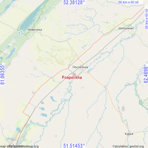
Pospelikha GPS coordinates[2]
51° 57' 0" North, 81° 46' 0.012" East
| Map corner | latitude | longitude |
|---|---|---|
| Upper-left | 52.38128°, | 81.06355° |
| Center: | 51.95°, | 81.76667° |
| Lower-right: | 51.51453°, | 82.4698° |
| Map W x H: | 96.4×96.4 km | = 59.9×59.9mi |
| max Lat: | 73.50819° ⇑69.5% North |
| Pospelikha: | 51.95° |
| min Lat: | ⇓30.5% South 41.28413° |
| min Long | Pospelikha | max Long |
| -179.12198° | 81.76667° | 179.35046° |
| W 79.8%⇐ | ⇒20.2% E |
Elevation
Elevation of Pospelikha is 188 m = 617 ft, and this is 14.6 m = 48 ft below average elevation for this country.
| Max E: |
2518 m = 8261 ft | 32.9% |
| Avg. | 202.6 m = 665 ft | |
| Pospelikha | 188 m = 617 ft | |
Min E: |
-28 m = -92 ft | 67.1% |
See also: Russia elevation on elevation.city.
Geographical zone
Pospelikha is located in North temperate zone (between Tropic of Cancer and the Arctic Circle). Distance of this North polar circle is 1624.9 km =1009.7 mi to North.| Distance of | km | miles | from Pospelikha |
|---|---|---|---|
| North Pole | 4230.8 | 2628.9 | to North |
| Arctic Circle | 1624.9 | 1009.7 | to North |
| Tropic Cancer | 3170.4 | 1970 | to South |
| Equator | 5776.3 | 3589.2 | to South |


Nearby cities:
15 places around Pospelikha: (largest is in red/bold)
• Aleysk
91.8 km =57 mi,  48°
48°
• Gornyak
108.3 km =67.3 mi,  191°
191°
• Krasnoshchekovo
73.1 km =45.4 mi,  115°
115°
• Mamontovo
84.6 km =52.6 mi,  353°
353°
• Novichikha
38.3 km =23.8 mi,  317°
317°
• Pervomayskiy
107.8 km =67 mi,  356°
356°
• Romanovo
82.9 km =51.5 mi,  333°
333°
• Rubtsovsk
61.9 km =38.5 mi,  218°
218°
• Shipunovo
38.5 km =23.9 mi, 53°
• Staroaleyskoye
106.2 km =66 mi,  171°
171°
• Ust’-Kalmanka
106.9 km =66.4 mi,  79°
79°
• Veseloyarsk
86.6 km =53.8 mi,  211°
211°
• Volchikha
96.8 km =60.1 mi,  274°
274°
• Zav’yalovo
114.2 km =71 mi, 329°
• Zmeinogorsk
92.9 km =57.7 mi,  161°
161°
Sources, notices
• [Note1] Compared only with cities in Russia existing in our database
• [Src1] Map data: © OpenStreetMap contributors (CC-BY-SA)
• [Src2] Other city data from geonames.org with taken over terms of usage.
• [Src3] Geographical zone / Annual Mean Temperature by Robert A. Rohde @ Wikipedia
