Krasnoshchekovo geodata
Krasnoshchekovo (Altai Krai) is a populated place; located in Russia in Asia/Barnaul (GMT+7) time zone. With population of 5,463 people, there are 2451 cities with bigger population in this country. Compared to other cities in Russia, 71.4% of cities are located further ↑North; 80.2% of cities are located further ←West and 79.3% of cities have lower elevation than Krasnoshchekovo. Note1


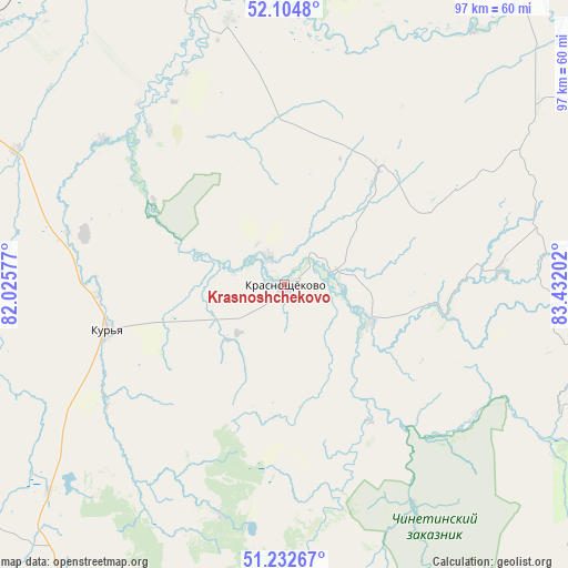
Krasnoshchekovo GPS coordinates[2]
51° 40' 14.988" North, 82° 43' 44.004" East
| Map corner | latitude | longitude |
|---|---|---|
| Upper-left | 52.1048°, | 82.02577° |
| Center: | 51.67083°, | 82.72889° |
| Lower-right: | 51.23267°, | 83.43202° |
| Map W x H: | 97×97 km | = 60.3×60.3mi |
| max Lat: | 73.50819° ⇑71.4% North |
| Krasnoshchekovo: | 51.67083° |
| min Lat: | ⇓28.6% South 41.28413° |
| min Long | Krasnoshchekovo | max Long |
| -179.12198° | 82.72889° | 179.35046° |
| W 80.2%⇐ | ⇒19.8% E |
Elevation
Elevation of Krasnoshchekovo is 242 m = 794 ft, and this is 39.4 m = 129 ft above average elevation for this country.
| Max E: |
2518 m = 8261 ft | 20.7% |
| Krasnoshchekovo | 242 m 794 ft | |
| Avg. | 202.6 m = 665 ft | |
Min E: |
-28 m = -92 ft | 79.3% |
See also: Russia elevation on elevation.city.
Geographical zone
Krasnoshchekovo is located in North temperate zone (between Tropic of Cancer and the Arctic Circle). Distance of this North polar circle is 1655.9 km =1028.9 mi to North.| Distance of | km | miles | from Krasnoshchekovo |
|---|---|---|---|
| North Pole | 4261.8 | 2648.2 | to North |
| Arctic Circle | 1655.9 | 1028.9 | to North |
| Tropic Cancer | 3139.3 | 1950.7 | to South |
| Equator | 5745.3 | 3570 | to South |


Nearby cities:
15 places around Krasnoshchekovo: (largest is in red/bold)
• Aleysk
91.4 km =56.8 mi,  2°
2°
• Anton’yevka
92.9 km =57.7 mi,  67°
67°
• Charyshskoye
65 km =40.4 mi,  117°
117°
• Nikolayevka
112 km =69.6 mi,  58°
58°
• Novichikha
109.4 km =68 mi,  302°
302°
• Petropavlovskoye
104.6 km =65 mi, 64°
• Pospelikha
73.1 km =45.4 mi, 295°
• Rubtsovsk
106.6 km =66.2 mi,  260°
260°
• Sentelek
88 km =54.7 mi,  126°
126°
• Shipunovo
64.6 km =40.1 mi,  327°
327°
• Soloneshnoye
109.7 km =68.2 mi,  90°
90°
• Staroaleyskoye
89.6 km =55.7 mi,  214°
214°
• Ust’-Charyshskaya Pristan’
102.7 km =63.8 mi,  38°
38°
• Ust’-Kalmanka
63.8 km =39.6 mi, 38°
• Zmeinogorsk
68 km =42.3 mi, 212°
Sources, notices
• [Note1] Compared only with cities in Russia existing in our database
• [Src1] Map data: © OpenStreetMap contributors (CC-BY-SA)
• [Src2] Other city data from geonames.org with taken over terms of usage.
• [Src3] Geographical zone / Annual Mean Temperature by Robert A. Rohde @ Wikipedia
