Rubtsovsk geodata
Rubtsovsk (Altai Krai) is a populated place; located in Russia in Asia/Barnaul (GMT+7) time zone. With population of 161,065 people, there are 118 cities with bigger population in this country. Compared to other cities in Russia, 72.5% of cities are located further ↑North; 79.6% of cities are located further ←West and 75.7% of cities have lower elevation than Rubtsovsk. Note1


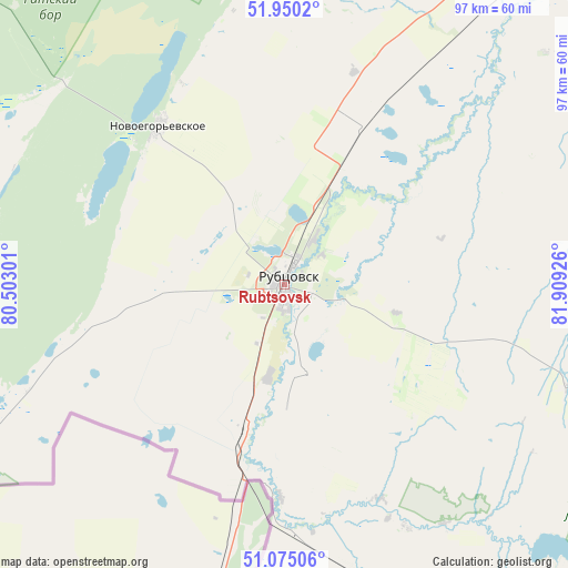
Rubtsovsk GPS coordinates[2]
51° 30' 53.028" North, 81° 12' 22.068" East
| Map corner | latitude | longitude |
|---|---|---|
| Upper-left | 51.9502°, | 80.50301° |
| Center: | 51.51473°, | 81.20613° |
| Lower-right: | 51.07506°, | 81.90926° |
| Map W x H: | 97.3×97.3 km | = 60.5×60.5mi |
| max Lat: | 73.50819° ⇑72.5% North |
| Rubtsovsk: | 51.51473° |
| min Lat: | ⇓27.5% South 41.28413° |
| min Long | Rubtsovsk | max Long |
| -179.12198° | 81.20613° | 179.35046° |
| W 79.6%⇐ | ⇒20.4% E |
Elevation
Elevation of Rubtsovsk is 220 m = 722 ft, and this is 17.4 m = 57 ft above average elevation for this country.
| Max E: |
2518 m = 8261 ft | 24.3% |
| Rubtsovsk | 220 m 722 ft | |
| Avg. | 202.6 m = 665 ft | |
Min E: |
-28 m = -92 ft | 75.7% |
See also: Rubtsovsk elevation on elevation.city.
Geographical zone
Rubtsovsk is located in North temperate zone (between Tropic of Cancer and the Arctic Circle). Distance of this North polar circle is 1673.3 km =1039.7 mi to North.| Distance of | km | miles | from Rubtsovsk |
|---|---|---|---|
| North Pole | 4279.2 | 2659 | to North |
| Arctic Circle | 1673.3 | 1039.7 | to North |
| Tropic Cancer | 3122 | 1939.9 | to South |
| Equator | 5727.9 | 3559.2 | to South |


Nearby cities:
15 places around Rubtsovsk: (largest is in red/bold)
• Bastan
125.4 km =77.9 mi,  287°
287°
• Gornyak
60.6 km =37.7 mi,  162°
162°
• Krasnoshchekovo
106.6 km =66.2 mi,  80°
80°
• Malinovoye Ozero
99.9 km =62.1 mi,  280°
280°
• Mikhaylovskoye
108.3 km =67.3 mi, 288°
• Novichikha
77.6 km =48.2 mi,  9°
9°
• Pospelikha
61.9 km =38.5 mi,  38°
38°
• Rodino
129.1 km =80.2 mi,  327°
327°
• Romanovo
122.7 km =76.2 mi,  0°
0°
• Shipunovo
99.7 km =62 mi, 44°
• Staroaleyskoye
79.1 km =49.2 mi,  135°
135°
• Uglovskoye
72.3 km =44.9 mi,  255°
255°
• Veseloyarsk
26.2 km =16.3 mi,  195°
195°
• Volchikha
80.6 km =50.1 mi,  313°
313°
• Zmeinogorsk
79.4 km =49.3 mi,  120°
120°
In other languages:
- In France: Roubtsovsk
- In German: Rubzowsk
- In Italian: Rubcovsk
- In Russian: Рубцовск
- In Chinese: 魯布佐夫斯克
Sources, notices
• [Note1] Compared only with cities in Russia existing in our database
• [Src1] Map data: © OpenStreetMap contributors (CC-BY-SA)
• [Src2] Other city data from geonames.org with taken over terms of usage.
• [Src3] Geographical zone / Annual Mean Temperature by Robert A. Rohde @ Wikipedia
