Staroaleyskoye geodata
Staroaleyskoye (Altai Krai) is a populated place; located in Russia in Asia/Barnaul (GMT+7) time zone. With population of 5,037 people, there are 2642 cities with bigger population in this country. Compared to other cities in Russia, 74.9% of cities are located further ↑North; 79.9% of cities are located further ←West and 83.8% of cities have lower elevation than Staroaleyskoye. Note1


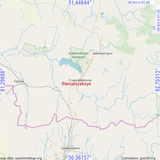
Staroaleyskoye GPS coordinates[2]
51° 0' 21.996" North, 82° 0' 0" East
| Map corner | latitude | longitude |
|---|---|---|
| Upper-left | 51.44644°, | 81.29688° |
| Center: | 51.00611°, | 82° |
| Lower-right: | 50.56157°, | 82.70313° |
| Map W x H: | 98.4×98.4 km | = 61.1×61.1mi |
| max Lat: | 73.50819° ⇑74.9% North |
| Staroaleyskoye: | 51.00611° |
| min Lat: | ⇓25.1% South 41.28413° |
| min Long | Staroaleyskoye | max Long |
| -179.12198° | 82° | 179.35046° |
| W 79.9%⇐ | ⇒20.1% E |
Elevation
Elevation of Staroaleyskoye is 298 m = 978 ft, and this is 95.4 m = 313 ft above average elevation for this country.
| Max E: |
2518 m = 8261 ft | 16.2% |
| Staroaleyskoye | 298 m 978 ft | |
| Avg. | 202.6 m = 665 ft | |
Min E: |
-28 m = -92 ft | 83.8% |
See also: Russia elevation on elevation.city.
Geographical zone
Staroaleyskoye is located in North temperate zone (between Tropic of Cancer and the Arctic Circle). Distance of this North polar circle is 1729.8 km =1074.8 mi to North.| Distance of | km | miles | from Staroaleyskoye |
|---|---|---|---|
| North Pole | 4335.7 | 2694.1 | to North |
| Arctic Circle | 1729.8 | 1074.8 | to North |
| Tropic Cancer | 3065.4 | 1904.8 | to South |
| Equator | 5671.3 | 3524 | to South |


Nearby cities:
15 places around Staroaleyskoye: (largest is in red/bold)
• Aleysk
173.8 km =108 mi,  18°
18°
• Charyshskoye
117.1 km =72.8 mi,  68°
68°
• Gornyak
37.4 km =23.2 mi,  267°
267°
• Krasnoshchekovo
89.6 km =55.7 mi,  34°
34°
• Malinovoye Ozero
171 km =106.3 mi,  295°
295°
• Novichikha
139.7 km =86.8 mi,  342°
342°
• Pospelikha
106.2 km =66 mi,  351°
351°
• Rubtsovsk
79.1 km =49.2 mi,  315°
315°
• Sentelek
124.2 km =77.2 mi,  79°
79°
• Shipunovo
129 km =80.2 mi,  6°
6°
• Uglovskoye
131.7 km =81.8 mi,  287°
287°
• Ust’-Kalmanka
153.3 km =95.3 mi,  36°
36°
• Veseloyarsk
69.7 km =43.3 mi, 296°
• Volchikha
159.6 km =99.2 mi,  314°
314°
• Zmeinogorsk
21.7 km =13.5 mi, 38°
Sources, notices
• [Note1] Compared only with cities in Russia existing in our database
• [Src1] Map data: © OpenStreetMap contributors (CC-BY-SA)
• [Src2] Other city data from geonames.org with taken over terms of usage.
• [Src3] Geographical zone / Annual Mean Temperature by Robert A. Rohde @ Wikipedia
