Turan geodata
Turan (Republic of Tyva) is a populated place; located in Russia in Asia/Krasnoyarsk (GMT+7) time zone. With population of 5,528 people, there are 2429 cities with bigger population in this country. Compared to other cities in Russia, 68.4% of cities are located further ↑North; 87% of cities are located further ←West and 97.9% of cities have lower elevation than Turan. Note1


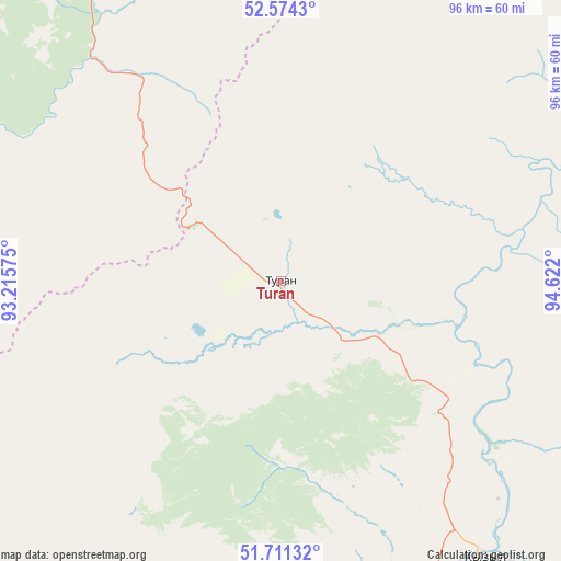
Turan GPS coordinates[2]
52° 8' 41.64" North, 93° 55' 7.932" East
| Map corner | latitude | longitude |
|---|---|---|
| Upper-left | 52.5743°, | 93.21575° |
| Center: | 52.1449°, | 93.91887° |
| Lower-right: | 51.71132°, | 94.622° |
| Map W x H: | 96×96 km | = 59.7×59.7mi |
| max Lat: | 73.50819° ⇑68.4% North |
| Turan: | 52.1449° |
| min Lat: | ⇓31.6% South 41.28413° |
| min Long | Turan | max Long |
| -179.12198° | 93.91887° | 179.35046° |
| W 87%⇐ | ⇒13% E |
Elevation
Elevation of Turan is 859 m = 2818 ft, and this is 656.4 m = 2154 ft above average elevation for this country.
| Max E: |
2518 m = 8261 ft | 2.1% |
| Turan | 859 m 2818 ft | |
| Avg. | 202.6 m = 665 ft | |
Min E: |
-28 m = -92 ft | 97.9% |
See also: Russia elevation on elevation.city.
Geographical zone
Turan is located in North temperate zone (between Tropic of Cancer and the Arctic Circle). Distance of this North polar circle is 1603.2 km =996.2 mi to North.| Distance of | km | miles | from Turan |
|---|---|---|---|
| North Pole | 4209.1 | 2615.4 | to North |
| Arctic Circle | 1603.2 | 996.2 | to North |
| Tropic Cancer | 3192.1 | 1983.5 | to South |
| Equator | 5798 | 3602.7 | to South |


Nearby cities:
15 places around Turan: (largest is in red/bold)
• Balgazyn
155.1 km =96.4 mi,  145°
145°
• Bay-Khaak
115.7 km =71.9 mi,  161°
161°
• Chadan
187.2 km =116.3 mi,  239°
239°
• Cherëmushki
186.9 km =116.1 mi,  295°
295°
• Kaa-Khem
75.9 km =47.2 mi,  132°
132°
• Karatuzskoye
177.3 km =110.2 mi,  336°
336°
• Khovu-Aksy
113.4 km =70.5 mi,  187°
187°
• Kyzyl
60.6 km =37.7 mi,  142°
142°
• Saryg-Sep
134.3 km =83.5 mi,  122°
122°
• Shagonar
96 km =59.7 mi,  224°
224°
• Shushenskoye
187.2 km =116.3 mi,  314°
314°
• Sukpak
72.3 km =44.9 mi, 137°
• Tanzybey
128 km =79.5 mi,  329°
329°
• Toora-Khem
153.7 km =95.5 mi,  76°
76°
• Yermakovskoye
162.1 km =100.7 mi,  320°
320°
Sources, notices
• [Note1] Compared only with cities in Russia existing in our database
• [Src1] Map data: © OpenStreetMap contributors (CC-BY-SA)
• [Src2] Other city data from geonames.org with taken over terms of usage.
• [Src3] Geographical zone / Annual Mean Temperature by Robert A. Rohde @ Wikipedia
