Saryg-Sep geodata
Saryg-Sep (Republic of Tyva) is a populated place; located in Russia in Asia/Krasnoyarsk (GMT+7) time zone. With population of 4,582 people, there are 2830 cities with bigger population in this country. Compared to other cities in Russia, 72.6% of cities are located further ↑North; 87.4% of cities are located further ←West and 96.2% of cities have lower elevation than Saryg-Sep. Note1


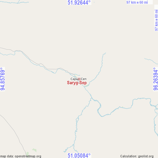
Saryg-Sep GPS coordinates[2]
51° 29' 26.664" North, 95° 33' 38.916" East
| Map corner | latitude | longitude |
|---|---|---|
| Upper-left | 51.92644°, | 94.85769° |
| Center: | 51.49074°, | 95.56081° |
| Lower-right: | 51.05084°, | 96.26394° |
| Map W x H: | 97.4×97.4 km | = 60.5×60.5mi |
| max Lat: | 73.50819° ⇑72.6% North |
| Saryg-Sep: | 51.49074° |
| min Lat: | ⇓27.4% South 41.28413° |
| min Long | Saryg-Sep | max Long |
| -179.12198° | 95.56081° | 179.35046° |
| W 87.4%⇐ | ⇒12.6% E |
Elevation
Elevation of Saryg-Sep is 710 m = 2329 ft, and this is 507.4 m = 1665 ft above average elevation for this country.
| Max E: |
2518 m = 8261 ft | 3.8% |
| Saryg-Sep | 710 m 2329 ft | |
| Avg. | 202.6 m = 665 ft | |
Min E: |
-28 m = -92 ft | 96.2% |
See also: Russia elevation on elevation.city.
Geographical zone
Saryg-Sep is located in North temperate zone (between Tropic of Cancer and the Arctic Circle). Distance of this North polar circle is 1675.9 km =1041.4 mi to North.| Distance of | km | miles | from Saryg-Sep |
|---|---|---|---|
| North Pole | 4281.8 | 2660.6 | to North |
| Arctic Circle | 1675.9 | 1041.4 | to North |
| Tropic Cancer | 3119.3 | 1938.2 | to South |
| Equator | 5725.2 | 3557.5 | to South |


Nearby cities:
15 places around Saryg-Sep: (largest is in red/bold)
• Balgazyn
60.1 km =37.3 mi,  204°
204°
• Bay-Khaak
84.6 km =52.6 mi,  244°
244°
• Chadan
276.9 km =172.1 mi,  265°
265°
• Erzin
139.7 km =86.8 mi,  191°
191°
• Kaa-Khem
61 km =37.9 mi,  290°
290°
• Khandagayty
259.1 km =161 mi,  251°
251°
• Khovu-Aksy
134.5 km =83.6 mi, 252°
• Kungurtug
169.2 km =105.1 mi,  125°
125°
• Kyzyl
80.3 km =49.9 mi, 287°
• Samagaltay
106.2 km =66 mi, 201°
• Shagonar
182 km =113.1 mi, 271°
• Sukpak
67 km =41.6 mi, 286°
• Tanzybey
254.9 km =158.4 mi,  315°
315°
• Toora-Khem
114.9 km =71.4 mi,  19°
19°
• Turan
134.3 km =83.5 mi,  302°
302°
Sources, notices
• [Note1] Compared only with cities in Russia existing in our database
• [Src1] Map data: © OpenStreetMap contributors (CC-BY-SA)
• [Src2] Other city data from geonames.org with taken over terms of usage.
• [Src3] Geographical zone / Annual Mean Temperature by Robert A. Rohde @ Wikipedia
