Shagonar geodata
Shagonar (Republic of Tyva) is a populated place; located in Russia in Asia/Krasnoyarsk (GMT+7) time zone. With population of 11,415 people, there are 1332 cities with bigger population in this country. Compared to other cities in Russia, 72.3% of cities are located further ↑North; 86.7% of cities are located further ←West and 93.6% of cities have lower elevation than Shagonar. Note1


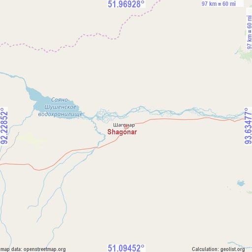
Shagonar GPS coordinates[2]
51° 32' 2.4" North, 92° 55' 53.904" East
| Map corner | latitude | longitude |
|---|---|---|
| Upper-left | 51.96928°, | 92.22852° |
| Center: | 51.534°, | 92.93164° |
| Lower-right: | 51.09452°, | 93.63477° |
| Map W x H: | 97.3×97.3 km | = 60.5×60.5mi |
| max Lat: | 73.50819° ⇑72.3% North |
| Shagonar: | 51.534° |
| min Lat: | ⇓27.7% South 41.28413° |
| min Long | Shagonar | max Long |
| -179.12198° | 92.93164° | 179.35046° |
| W 86.7%⇐ | ⇒13.3% E |
Elevation
Elevation of Shagonar is 560 m = 1837 ft, and this is 357.4 m = 1173 ft above average elevation for this country.
| Max E: |
2518 m = 8261 ft | 6.4% |
| Shagonar | 560 m 1837 ft | |
| Avg. | 202.6 m = 665 ft | |
Min E: |
-28 m = -92 ft | 93.6% |
See also: Russia elevation on elevation.city.
Geographical zone
Shagonar is located in North temperate zone (between Tropic of Cancer and the Arctic Circle). Distance of this North polar circle is 1671.1 km =1038.4 mi to North.| Distance of | km | miles | from Shagonar |
|---|---|---|---|
| North Pole | 4277 | 2657.6 | to North |
| Arctic Circle | 1671.1 | 1038.4 | to North |
| Tropic Cancer | 3124.1 | 1941.2 | to South |
| Equator | 5730 | 3560.5 | to South |


Nearby cities:
15 places around Shagonar: (largest is in red/bold)
• Ak-Dovurak
166.5 km =103.5 mi,  256°
256°
• Balgazyn
168.6 km =104.8 mi,  110°
110°
• Bay-Khaak
114.2 km =71 mi, 111°
• Chadan
97.6 km =60.6 mi,  253°
253°
• Cherëmushki
179.6 km =111.6 mi,  324°
324°
• Kaa-Khem
125.5 km =78 mi,  82°
82°
• Khandagayty
108.2 km =67.2 mi,  214°
214°
• Khovu-Aksy
70.2 km =43.6 mi,  129°
129°
• Kyzyl
106.9 km =66.4 mi, 79°
• Kyzyl-Mazhalyk
168.9 km =104.9 mi, 255°
• Samagaltay
178.1 km =110.7 mi, 125°
• Sukpak
118.4 km =73.6 mi, 82°
• Sut-Khol’
114.4 km =71.1 mi, 262°
• Tanzybey
177.8 km =110.5 mi,  0°
0°
• Turan
96 km =59.7 mi,  44°
44°
Sources, notices
• [Note1] Compared only with cities in Russia existing in our database
• [Src1] Map data: © OpenStreetMap contributors (CC-BY-SA)
• [Src2] Other city data from geonames.org with taken over terms of usage.
• [Src3] Geographical zone / Annual Mean Temperature by Robert A. Rohde @ Wikipedia
