Khovu-Aksy geodata
Khovu-Aksy (Republic of Tyva) is a populated place; located in Russia in Asia/Krasnoyarsk (GMT+7) time zone. With population of 3,675 people, there are 3292 cities with bigger population in this country. Compared to other cities in Russia, 74.3% of cities are located further ↑North; 86.9% of cities are located further ←West and 98.7% of cities have lower elevation than Khovu-Aksy. Note1


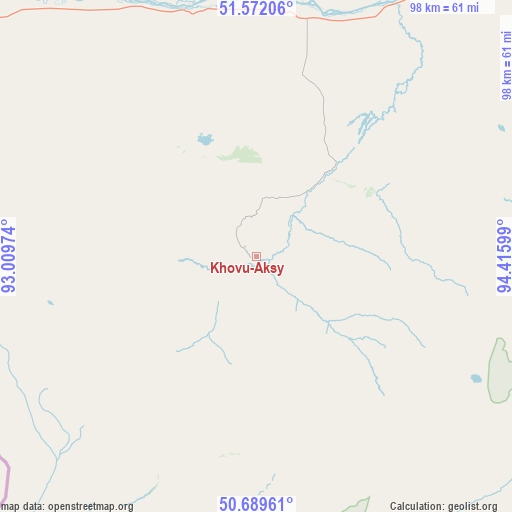
Khovu-Aksy GPS coordinates[2]
51° 7' 58.584" North, 93° 42' 46.296" East
| Map corner | latitude | longitude |
|---|---|---|
| Upper-left | 51.57206°, | 93.00974° |
| Center: | 51.13294°, | 93.71286° |
| Lower-right: | 50.68961°, | 94.41599° |
| Map W x H: | 98.1×98.1 km | = 61×61mi |
| max Lat: | 73.50819° ⇑74.3% North |
| Khovu-Aksy: | 51.13294° |
| min Lat: | ⇓25.7% South 41.28413° |
| min Long | Khovu-Aksy | max Long |
| -179.12198° | 93.71286° | 179.35046° |
| W 86.9%⇐ | ⇒13.1% E |
Elevation
Elevation of Khovu-Aksy is 1037 m = 3402 ft, and this is 834.4 m = 2738 ft above average elevation for this country.
| Max E: |
2518 m = 8261 ft | 1.3% |
| Khovu-Aksy | 1037 m 3402 ft | |
| Avg. | 202.6 m = 665 ft | |
Min E: |
-28 m = -92 ft | 98.7% |
See also: Russia elevation on elevation.city.
Geographical zone
Khovu-Aksy is located in North temperate zone (between Tropic of Cancer and the Arctic Circle). Distance of this North polar circle is 1715.7 km =1066.1 mi to North.| Distance of | km | miles | from Khovu-Aksy |
|---|---|---|---|
| North Pole | 4321.6 | 2685.3 | to North |
| Arctic Circle | 1715.7 | 1066.1 | to North |
| Tropic Cancer | 3079.5 | 1913.5 | to South |
| Equator | 5685.4 | 3532.7 | to South |


Nearby cities:
15 places around Khovu-Aksy: (largest is in red/bold)
• Ak-Dovurak
217.1 km =134.9 mi,  271°
271°
• Balgazyn
105 km =65.2 mi,  98°
98°
• Bay-Khaak
52.5 km =32.6 mi,  86°
86°
• Chadan
149.3 km =92.8 mi,  276°
276°
• Erzin
140.9 km =87.6 mi,  133°
133°
• Kaa-Khem
93.6 km =58.2 mi,  49°
49°
• Khandagayty
124.7 km =77.5 mi,  249°
249°
• Kyzyl
82.2 km =51.1 mi,  38°
38°
• Kyzyl-Mazhalyk
218.5 km =135.8 mi, 270°
• Samagaltay
108.2 km =67.2 mi,  123°
123°
• Saryg-Sep
134.5 km =83.6 mi,  72°
72°
• Shagonar
70.2 km =43.6 mi,  309°
309°
• Sukpak
87.2 km =54.2 mi, 47°
• Sut-Khol’
171.1 km =106.3 mi, 280°
• Turan
113.4 km =70.5 mi,  7°
7°
Sources, notices
• [Note1] Compared only with cities in Russia existing in our database
• [Src1] Map data: © OpenStreetMap contributors (CC-BY-SA)
• [Src2] Other city data from geonames.org with taken over terms of usage.
• [Src3] Geographical zone / Annual Mean Temperature by Robert A. Rohde @ Wikipedia
