Bay-Khaak geodata
Bay-Khaak (Republic of Tyva) is a populated place; located in Russia in Asia/Krasnoyarsk (GMT+7) time zone. With population of 3,058 people, there are 3737 cities with bigger population in this country. Compared to other cities in Russia, 74.2% of cities are located further ↑North; 87% of cities are located further ←West and 98.1% of cities have lower elevation than Bay-Khaak. Note1


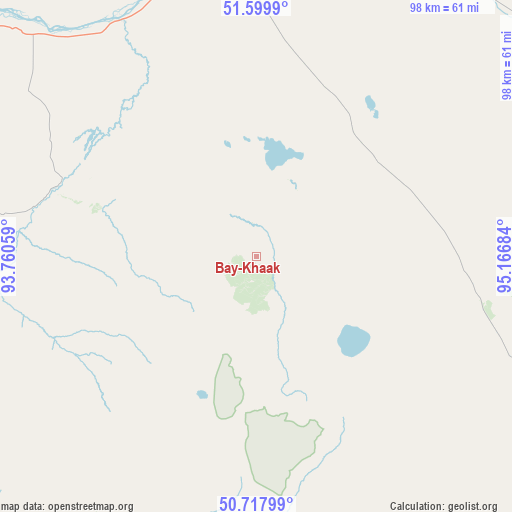
Bay-Khaak GPS coordinates[2]
51° 9' 39.78" North, 94° 27' 49.356" East
| Map corner | latitude | longitude |
|---|---|---|
| Upper-left | 51.5999°, | 93.76059° |
| Center: | 51.16105°, | 94.46371° |
| Lower-right: | 50.71799°, | 95.16684° |
| Map W x H: | 98.1×98.1 km | = 61×61mi |
| max Lat: | 73.50819° ⇑74.2% North |
| Bay-Khaak: | 51.16105° |
| min Lat: | ⇓25.8% South 41.28413° |
| min Long | Bay-Khaak | max Long |
| -179.12198° | 94.46371° | 179.35046° |
| W 87%⇐ | ⇒13% E |
Elevation
Elevation of Bay-Khaak is 888 m = 2913 ft, and this is 685.4 m = 2249 ft above average elevation for this country.
| Max E: |
2518 m = 8261 ft | 1.9% |
| Bay-Khaak | 888 m 2913 ft | |
| Avg. | 202.6 m = 665 ft | |
Min E: |
-28 m = -92 ft | 98.1% |
See also: Russia elevation on elevation.city.
Geographical zone
Bay-Khaak is located in North temperate zone (between Tropic of Cancer and the Arctic Circle). Distance of this North polar circle is 1712.6 km =1064.2 mi to North.| Distance of | km | miles | from Bay-Khaak |
|---|---|---|---|
| North Pole | 4318.5 | 2683.4 | to North |
| Arctic Circle | 1712.6 | 1064.2 | to North |
| Tropic Cancer | 3082.7 | 1915.5 | to South |
| Equator | 5688.6 | 3534.7 | to South |


Nearby cities:
15 places around Bay-Khaak: (largest is in red/bold)
• Balgazyn
54.5 km =33.9 mi,  109°
109°
• Chadan
201 km =124.9 mi,  273°
273°
• Erzin
111.6 km =69.3 mi,  153°
153°
• Kaa-Khem
61 km =37.9 mi,  17°
17°
• Khandagayty
175.6 km =109.1 mi,  254°
254°
• Khovu-Aksy
52.5 km =32.6 mi, 266°
• Kungurtug
223.5 km =138.9 mi, 106°
• Kyzyl
61.1 km =38 mi,  359°
359°
• Samagaltay
72.8 km =45.2 mi, 148°
• Saryg-Sep
84.6 km =52.6 mi,  64°
64°
• Shagonar
114.2 km =71 mi,  291°
291°
• Sukpak
57.4 km =35.7 mi,  11°
11°
• Sut-Khol’
222.2 km =138.1 mi,  277°
277°
• Toora-Khem
184.3 km =114.5 mi,  38°
38°
• Turan
115.7 km =71.9 mi,  341°
341°
Sources, notices
• [Note1] Compared only with cities in Russia existing in our database
• [Src1] Map data: © OpenStreetMap contributors (CC-BY-SA)
• [Src2] Other city data from geonames.org with taken over terms of usage.
• [Src3] Geographical zone / Annual Mean Temperature by Robert A. Rohde @ Wikipedia
