Kyzyl geodata
Kyzyl (Republic of Tyva) is a seat of a first-order administrative division; located in Russia in Asia/Krasnoyarsk (GMT+7) time zone. With population of 108,240 people, there are 188 cities with bigger population in this country. Compared to other cities in Russia, 71.1% of cities are located further ↑North; 87% of cities are located further ←West and 94.5% of cities have lower elevation than Kyzyl. Note1


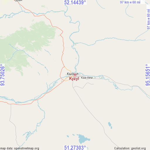
Kyzyl GPS coordinates[2]
51° 42' 38.916" North, 94° 27' 12.168" East
| Map corner | latitude | longitude |
|---|---|---|
| Upper-left | 52.14439°, | 93.75026° |
| Center: | 51.71081°, | 94.45338° |
| Lower-right: | 51.27303°, | 95.15651° |
| Map W x H: | 96.9×96.9 km | = 60.2×60.2mi |
| max Lat: | 73.50819° ⇑71.1% North |
| Kyzyl: | 51.71081° |
| min Lat: | ⇓28.9% South 41.28413° |
| min Long | Kyzyl | max Long |
| -179.12198° | 94.45338° | 179.35046° |
| W 87%⇐ | ⇒13% E |
Elevation
Elevation of Kyzyl is 608 m = 1995 ft, and this is 405.4 m = 1330 ft above average elevation for this country.
| Max E: |
2518 m = 8261 ft | 5.5% |
| Kyzyl | 608 m 1995 ft | |
| Avg. | 202.6 m = 665 ft | |
Min E: |
-28 m = -92 ft | 94.5% |
See also: Kyzyl elevation on elevation.city.
Geographical zone
Kyzyl is located in North temperate zone (between Tropic of Cancer and the Arctic Circle). Distance of this North polar circle is 1651.5 km =1026.2 mi to North.| Distance of | km | miles | from Kyzyl |
|---|---|---|---|
| North Pole | 4257.4 | 2645.4 | to North |
| Arctic Circle | 1651.5 | 1026.2 | to North |
| Tropic Cancer | 3143.8 | 1953.5 | to South |
| Equator | 5749.7 | 3572.7 | to South |


Nearby cities:
15 places around Kyzyl: (largest is in red/bold)
• Balgazyn
94.5 km =58.7 mi,  146°
146°
• Bay-Khaak
61.1 km =38 mi,  179°
179°
• Chadan
204.3 km =126.9 mi,  256°
256°
• Erzin
168.8 km =104.9 mi,  162°
162°
• Kaa-Khem
19.5 km =12.1 mi,  98°
98°
• Khandagayty
199.5 km =124 mi,  236°
236°
• Khovu-Aksy
82.2 km =51.1 mi,  218°
218°
• Samagaltay
129.1 km =80.2 mi, 162°
• Saryg-Sep
80.3 km =49.9 mi,  107°
107°
• Shagonar
106.9 km =66.4 mi, 259°
• Sukpak
13.3 km =8.3 mi, 111°
• Sut-Khol’
221.1 km =137.4 mi, 261°
• Tanzybey
188.3 km =117 mi,  327°
327°
• Toora-Khem
141.3 km =87.8 mi,  53°
53°
• Turan
60.6 km =37.7 mi,  322°
322°
Sources, notices
• [Note1] Compared only with cities in Russia existing in our database
• [Src1] Map data: © OpenStreetMap contributors (CC-BY-SA)
• [Src2] Other city data from geonames.org with taken over terms of usage.
• [Src3] Geographical zone / Annual Mean Temperature by Robert A. Rohde @ Wikipedia
