Topol’noye geodata
Topol’noye (Altai Krai) is a populated place; located in Russia in Asia/Barnaul (GMT+7) time zone. With population of 1,100 people, there are 4575 cities with bigger population in this country. Compared to other cities in Russia, 72.5% of cities are located further ↑North; 81.8% of cities are located further ←West and 92.7% of cities have lower elevation than Topol’noye. Note1


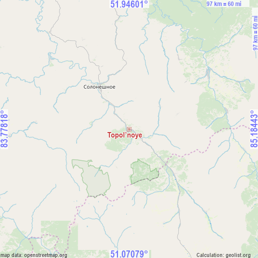
Topol’noye GPS coordinates[2]
51° 30' 37.8" North, 84° 28' 52.68" East
| Map corner | latitude | longitude |
|---|---|---|
| Upper-left | 51.94601°, | 83.77818° |
| Center: | 51.5105°, | 84.4813° |
| Lower-right: | 51.07079°, | 85.18443° |
| Map W x H: | 97.3×97.3 km | = 60.5×60.5mi |
| max Lat: | 73.50819° ⇑72.5% North |
| Topol’noye: | 51.5105° |
| min Lat: | ⇓27.5% South 41.28413° |
| min Long | Topol’noye | max Long |
| -179.12198° | 84.4813° | 179.35046° |
| W 81.8%⇐ | ⇒18.2% E |
Elevation
Elevation of Topol’noye is 525 m = 1722 ft, and this is 322.4 m = 1058 ft above average elevation for this country.
| Max E: |
2518 m = 8261 ft | 7.3% |
| Topol’noye | 525 m 1722 ft | |
| Avg. | 202.6 m = 665 ft | |
Min E: |
-28 m = -92 ft | 92.7% |
See also: Russia elevation on elevation.city.
Geographical zone
Topol’noye is located in North temperate zone (between Tropic of Cancer and the Arctic Circle). Distance of this North polar circle is 1673.7 km =1040 mi to North.| Distance of | km | miles | from Topol’noye |
|---|---|---|---|
| North Pole | 4279.6 | 2659.2 | to North |
| Arctic Circle | 1673.7 | 1040 | to North |
| Tropic Cancer | 3121.5 | 1939.6 | to South |
| Equator | 5727.4 | 3558.8 | to South |


Nearby cities:
15 places around Topol’noye: (largest is in red/bold)
• Altayskoye
76.6 km =47.6 mi,  49°
49°
• Anton’yevka
64.3 km =40 mi,  327°
327°
• Belokurikha
64.3 km =40 mi,  32°
32°
• Charyshskoye
65.1 km =40.5 mi,  258°
258°
• Cherga
75.1 km =46.7 mi,  85°
85°
• Il’inka
44.1 km =27.4 mi,  100°
100°
• Novopokrovka
79.2 km =49.2 mi,  357°
357°
• Novotyryshkino
70.1 km =43.6 mi,  24°
24°
• Petropavlovskoye
67.4 km =41.9 mi,  337°
337°
• Sarasa
72.8 km =45.2 mi,  55°
55°
• Sentelek
61.1 km =38 mi,  235°
235°
• Soloneshnoye
19.5 km =12.1 mi, 325°
• Starobelokurikha
73.3 km =45.5 mi, 34°
• Sychëvka
63.5 km =39.5 mi, 18°
• Ust’-Kan
67.7 km =42.1 mi,  163°
163°
Sources, notices
• [Note1] Compared only with cities in Russia existing in our database
• [Src1] Map data: © OpenStreetMap contributors (CC-BY-SA)
• [Src2] Other city data from geonames.org with taken over terms of usage.
• [Src3] Geographical zone / Annual Mean Temperature by Robert A. Rohde @ Wikipedia
