Charyshskoye geodata
Charyshskoye (Altai Krai) is a populated place; located in Russia in Asia/Barnaul (GMT+7) time zone. With population of 3,371 people, there are 3485 cities with bigger population in this country. Compared to other cities in Russia, 73.1% of cities are located further ↑North; 81% of cities are located further ←West and 88.9% of cities have lower elevation than Charyshskoye. Note1


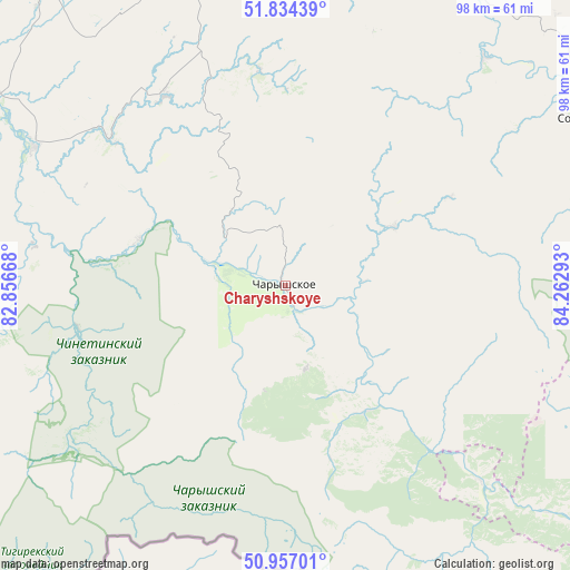
Charyshskoye GPS coordinates[2]
51° 23' 52.08" North, 83° 33' 35.28" East
| Map corner | latitude | longitude |
|---|---|---|
| Upper-left | 51.83439°, | 82.85668° |
| Center: | 51.3978°, | 83.5598° |
| Lower-right: | 50.95701°, | 84.26293° |
| Map W x H: | 97.6×97.6 km | = 60.6×60.6mi |
| max Lat: | 73.50819° ⇑73.1% North |
| Charyshskoye: | 51.3978° |
| min Lat: | ⇓26.9% South 41.28413° |
| min Long | Charyshskoye | max Long |
| -179.12198° | 83.5598° | 179.35046° |
| W 81%⇐ | ⇒19% E |
Elevation
Elevation of Charyshskoye is 425 m = 1394 ft, and this is 222.4 m = 730 ft above average elevation for this country.
| Max E: |
2518 m = 8261 ft | 11.1% |
| Charyshskoye | 425 m 1394 ft | |
| Avg. | 202.6 m = 665 ft | |
Min E: |
-28 m = -92 ft | 88.9% |
See also: Russia elevation on elevation.city.
Geographical zone
Charyshskoye is located in North temperate zone (between Tropic of Cancer and the Arctic Circle). Distance of this North polar circle is 1686.3 km =1047.8 mi to North.| Distance of | km | miles | from Charyshskoye |
|---|---|---|---|
| North Pole | 4292.2 | 2667 | to North |
| Arctic Circle | 1686.3 | 1047.8 | to North |
| Tropic Cancer | 3109 | 1931.8 | to South |
| Equator | 5714.9 | 3551.1 | to South |


Nearby cities:
15 places around Charyshskoye: (largest is in red/bold)
• Anton’yevka
72.4 km =45 mi,  23°
23°
• Il’inka
107.4 km =66.7 mi,  87°
87°
• Krasnoshchekovo
65 km =40.4 mi,  297°
297°
• Nikolayevka
96.5 km =60 mi, 23°
• Novopokrovka
109.6 km =68.1 mi,  33°
33°
• Pautovo
103.2 km =64.1 mi, 28°
• Petropavlovskoye
83.8 km =52.1 mi, 26°
• Sentelek
25.5 km =15.8 mi,  148°
148°
• Soloneshnoye
59.8 km =37.2 mi,  61°
61°
• Sychëvka
111 km =69 mi,  49°
49°
• Topol’noye
65.1 km =40.5 mi,  78°
78°
• Ust’-Charyshskaya Pristan’
110.9 km =68.9 mi,  3°
3°
• Ust’-Kalmanka
82.3 km =51.1 mi,  347°
347°
• Ust’-Kan
98.7 km =61.3 mi,  121°
121°
• Zmeinogorsk
98.6 km =61.3 mi,  254°
254°
Sources, notices
• [Note1] Compared only with cities in Russia existing in our database
• [Src1] Map data: © OpenStreetMap contributors (CC-BY-SA)
• [Src2] Other city data from geonames.org with taken over terms of usage.
• [Src3] Geographical zone / Annual Mean Temperature by Robert A. Rohde @ Wikipedia
