Sentelek geodata
Sentelek (Altai Krai) is a populated place; located in Russia in Asia/Barnaul (GMT+7) time zone. With population of 1,000 people, there are 4627 cities with bigger population in this country. Compared to other cities in Russia, 73.9% of cities are located further ↑North; 81.2% of cities are located further ←West and 94% of cities have lower elevation than Sentelek. Note1


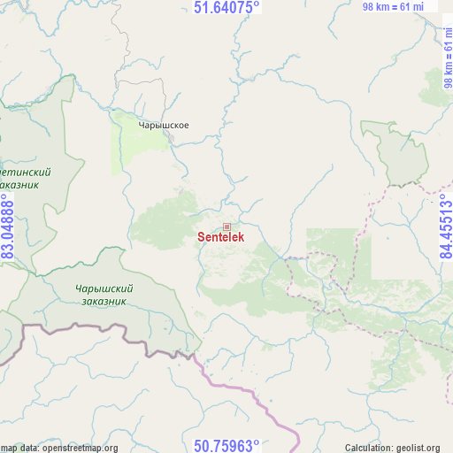
Sentelek GPS coordinates[2]
51° 12' 8.28" North, 83° 45' 7.2" East
| Map corner | latitude | longitude |
|---|---|---|
| Upper-left | 51.64075°, | 83.04888° |
| Center: | 51.2023°, | 83.752° |
| Lower-right: | 50.75963°, | 84.45513° |
| Map W x H: | 98×98 km | = 60.9×60.9mi |
| max Lat: | 73.50819° ⇑73.9% North |
| Sentelek: | 51.2023° |
| min Lat: | ⇓26.1% South 41.28413° |
| min Long | Sentelek | max Long |
| -179.12198° | 83.752° | 179.35046° |
| W 81.2%⇐ | ⇒18.8% E |
Elevation
Elevation of Sentelek is 582 m = 1909 ft, and this is 379.4 m = 1245 ft above average elevation for this country.
| Max E: |
2518 m = 8261 ft | 6% |
| Sentelek | 582 m 1909 ft | |
| Avg. | 202.6 m = 665 ft | |
Min E: |
-28 m = -92 ft | 94% |
See also: Russia elevation on elevation.city.
Geographical zone
Sentelek is located in North temperate zone (between Tropic of Cancer and the Arctic Circle). Distance of this North polar circle is 1708 km =1061.3 mi to North.| Distance of | km | miles | from Sentelek |
|---|---|---|---|
| North Pole | 4313.9 | 2680.5 | to North |
| Arctic Circle | 1708 | 1061.3 | to North |
| Tropic Cancer | 3087.2 | 1918.3 | to South |
| Equator | 5693.2 | 3537.6 | to South |


Nearby cities:
15 places around Sentelek: (largest is in red/bold)
• Anton’yevka
89.6 km =55.7 mi,  9°
9°
• Belokurikha
122.8 km =76.3 mi,  44°
44°
• Charyshskoye
25.5 km =15.8 mi,  328°
328°
• Il’inka
97.9 km =60.8 mi,  74°
74°
• Krasnoshchekovo
88 km =54.7 mi,  306°
306°
• Nikolayevka
113 km =70.2 mi, 13°
• Novopokrovka
122.8 km =76.3 mi,  22°
22°
• Pautovo
118.2 km =73.4 mi, 17°
• Petropavlovskoye
99.7 km =62 mi, 14°
• Soloneshnoye
63.8 km =39.6 mi, 38°
• Sychëvka
118 km =73.3 mi, 36°
• Topol’noye
61.1 km =38 mi,  55°
55°
• Ust’-Kalmanka
106.7 km =66.3 mi,  343°
343°
• Ust’-Kan
76.8 km =47.7 mi,  113°
113°
• Zmeinogorsk
108.6 km =67.5 mi,  267°
267°
Sources, notices
• [Note1] Compared only with cities in Russia existing in our database
• [Src1] Map data: © OpenStreetMap contributors (CC-BY-SA)
• [Src2] Other city data from geonames.org with taken over terms of usage.
• [Src3] Geographical zone / Annual Mean Temperature by Robert A. Rohde @ Wikipedia
