Tegul’det geodata
Tegul’det (Tomsk Oblast) is a populated place; located in Russia in Asia/Tomsk (GMT+7) time zone. With population of 4,800 people, there are 2741 cities with bigger population in this country. Compared to other cities in Russia, 79.1% of cities are located further ↓South; 85.2% of cities are located further ←West and 56.6% of cities have higher elevation than Tegul’det. Note1


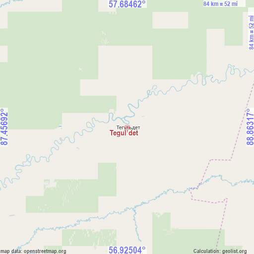
Tegul’det GPS coordinates[2]
57° 18' 24.444" North, 88° 9' 36.144" East
| Map corner | latitude | longitude |
|---|---|---|
| Upper-left | 57.68462°, | 87.45692° |
| Center: | 57.30679°, | 88.16004° |
| Lower-right: | 56.92504°, | 88.86317° |
| Map W x H: | 84.5×84.5 km | = 52.5×52.5mi |
| max Lat: | 73.50819° ⇑20.9% North |
| Tegul’det: | 57.30679° |
| min Lat: | ⇓79.1% South 41.28413° |
| min Long | Tegul’det | max Long |
| -179.12198° | 88.16004° | 179.35046° |
| W 85.2%⇐ | ⇒14.8% E |
Elevation
Elevation of Tegul’det is 131 m = 430 ft, and this is 71.6 m = 235 ft below average elevation for this country.
| Max E: |
2518 m = 8261 ft | 56.6% |
| Avg. | 202.6 m = 665 ft | |
| Tegul’det | 131 m = 430 ft | |
Min E: |
-28 m = -92 ft | 43.4% |
See also: Russia elevation on elevation.city.
Geographical zone
Tegul’det is located in North temperate zone (between Tropic of Cancer and the Arctic Circle). Distance of this North polar circle is 1029.3 km =639.6 mi to North.| Distance of | km | miles | from Tegul’det |
|---|---|---|---|
| North Pole | 3635.1 | 2258.7 | to North |
| Arctic Circle | 1029.3 | 639.6 | to North |
| Tropic Cancer | 3766 | 2340.1 | to South |
| Equator | 6371.9 | 3959.3 | to South |


Nearby cities:
15 places around Tegul’det: (largest is in red/bold)
• Asino
126.3 km =78.5 mi,  254°
254°
• Bogotol
148.1 km =92 mi,  145°
145°
• Itatskiy
147.6 km =91.7 mi,  158°
158°
• Izhmorskiy
154.7 km =96.1 mi,  216°
216°
• Mariinsk
124.1 km =77.1 mi,  191°
191°
• Novobirilyussy
157.1 km =97.6 mi,  104°
104°
• Pervomayskoye
119 km =73.9 mi,  257°
257°
• Suslovo
121.2 km =75.3 mi,  181°
181°
• Svetlyy
139.3 km =86.6 mi, 251°
• Tisul’
172 km =106.9 mi, 176°
• Tyazhinskiy
134.2 km =83.4 mi,  170°
170°
• Tyukhtet
110.3 km =68.5 mi,  140°
140°
• Verkh-Chebula
145.7 km =90.5 mi, 193°
• Yaya
161.2 km =100.2 mi, 220°
• Zyryanskoye
106.7 km =66.3 mi,  240°
240°
Sources, notices
• [Note1] Compared only with cities in Russia existing in our database
• [Src1] Map data: © OpenStreetMap contributors (CC-BY-SA)
• [Src2] Other city data from geonames.org with taken over terms of usage.
• [Src3] Geographical zone / Annual Mean Temperature by Robert A. Rohde @ Wikipedia
