Slavgorodskoye geodata
Slavgorodskoye (Altai Krai) is a populated place; located in Russia in Asia/Barnaul (GMT+7) time zone. With population of 3,683 people, there are 3284 cities with bigger population in this country. Compared to other cities in Russia, 62.6% of cities are located further ↑North; 78.9% of cities are located further ←West and 65.7% of cities have higher elevation than Slavgorodskoye. Note1


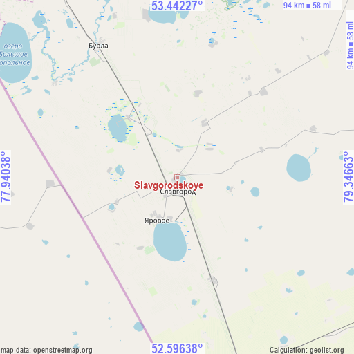
Slavgorodskoye GPS coordinates[2]
53° 1' 17.04" North, 78° 38' 36.6" East
| Map corner | latitude | longitude |
|---|---|---|
| Upper-left | 53.44227°, | 77.94038° |
| Center: | 53.0214°, | 78.6435° |
| Lower-right: | 52.59638°, | 79.34663° |
| Map W x H: | 94.1×94.1 km | = 58.5×58.5mi |
| max Lat: | 73.50819° ⇑62.6% North |
| Slavgorodskoye: | 53.0214° |
| min Lat: | ⇓37.4% South 41.28413° |
| min Long | Slavgorodskoye | max Long |
| -179.12198° | 78.6435° | 179.35046° |
| W 78.9%⇐ | ⇒21.1% E |
Elevation
Elevation of Slavgorodskoye is 112 m = 367 ft, and this is 90.6 m = 297 ft below average elevation for this country.
| Max E: |
2518 m = 8261 ft | 65.7% |
| Avg. | 202.6 m = 665 ft | |
| Slavgorodskoye | 112 m = 367 ft | |
Min E: |
-28 m = -92 ft | 34.3% |
See also: Russia elevation on elevation.city.
Geographical zone
Slavgorodskoye is located in North temperate zone (between Tropic of Cancer and the Arctic Circle). Distance of this North polar circle is 1505.7 km =935.6 mi to North.| Distance of | km | miles | from Slavgorodskoye |
|---|---|---|---|
| North Pole | 4111.6 | 2554.8 | to North |
| Arctic Circle | 1505.7 | 935.6 | to North |
| Tropic Cancer | 3289.5 | 2044 | to South |
| Equator | 5895.4 | 3663.2 | to South |


Nearby cities:
15 places around Slavgorodskoye: (largest is in red/bold)
• Blagoveshchenka
84.6 km =52.6 mi,  104°
104°
• Burla
40.8 km =25.4 mi,  329°
329°
• Bursol’
21.1 km =13.1 mi,  320°
320°
• Gal’bshtadt
32.2 km =20 mi,  44°
44°
• Grishkovka
15.9 km =9.9 mi,  26°
26°
• Karasuk
89.1 km =55.4 mi, 333°
• Khabary
89.5 km =55.6 mi, 41°
• Kulunda
54.4 km =33.8 mi,  158°
158°
• Kusak
29.7 km =18.5 mi, 40°
• Novopeschanoye
43.9 km =27.3 mi,  349°
349°
• Podsosnovo
43.1 km =26.8 mi, 25°
• Slavgorod
2.6 km =1.6 mi,  177°
177°
• Tabuny
28.9 km =18 mi, 160°
• Ust’yanka
48.4 km =30.1 mi,  7°
7°
• Yarovoye
11.3 km =7 mi,  202°
202°
Sources, notices
• [Note1] Compared only with cities in Russia existing in our database
• [Src1] Map data: © OpenStreetMap contributors (CC-BY-SA)
• [Src2] Other city data from geonames.org with taken over terms of usage.
• [Src3] Geographical zone / Annual Mean Temperature by Robert A. Rohde @ Wikipedia
