Sheregesh geodata
Sheregesh (Kemerovo Oblast) is a populated place; located in Russia in Asia/Novokuznetsk (GMT+7) time zone. With population of 10,114 people, there are 1492 cities with bigger population in this country. Compared to other cities in Russia, 63.3% of cities are located further ↑North; 85.1% of cities are located further ←West and 94.4% of cities have lower elevation than Sheregesh. Note1


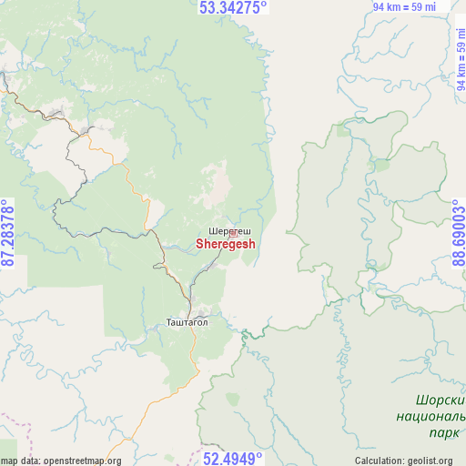
Sheregesh GPS coordinates[2]
52° 55' 15.24" North, 87° 59' 12.84" East
| Map corner | latitude | longitude |
|---|---|---|
| Upper-left | 53.34275°, | 87.28378° |
| Center: | 52.9209°, | 87.9869° |
| Lower-right: | 52.4949°, | 88.69003° |
| Map W x H: | 94.3×94.3 km | = 58.6×58.6mi |
| max Lat: | 73.50819° ⇑63.3% North |
| Sheregesh: | 52.9209° |
| min Lat: | ⇓36.7% South 41.28413° |
| min Long | Sheregesh | max Long |
| -179.12198° | 87.9869° | 179.35046° |
| W 85.1%⇐ | ⇒14.9% E |
Elevation
Elevation of Sheregesh is 603 m = 1978 ft, and this is 400.4 m = 1314 ft above average elevation for this country.
| Max E: |
2518 m = 8261 ft | 5.6% |
| Sheregesh | 603 m 1978 ft | |
| Avg. | 202.6 m = 665 ft | |
Min E: |
-28 m = -92 ft | 94.4% |
See also: Russia elevation on elevation.city.
Geographical zone
Sheregesh is located in North temperate zone (between Tropic of Cancer and the Arctic Circle). Distance of this North polar circle is 1516.9 km =942.6 mi to North.| Distance of | km | miles | from Sheregesh |
|---|---|---|---|
| North Pole | 4122.8 | 2561.8 | to North |
| Arctic Circle | 1516.9 | 942.6 | to North |
| Tropic Cancer | 3278.3 | 2037 | to South |
| Equator | 5884.3 | 3656.3 | to South |


Nearby cities:
15 places around Sheregesh: (largest is in red/bold)
• Chugunash
14.7 km =9.1 mi,  248°
248°
• Dmitriyevka
89.9 km =55.9 mi,  233°
233°
• Kaltan
84.2 km =52.3 mi,  324°
324°
• Kaz
45.4 km =28.2 mi,  268°
268°
• Kuzedeyevo
69.4 km =43.1 mi,  311°
311°
• Mezhdurechensk
86.1 km =53.5 mi,  3°
3°
• Mundybash
56.2 km =34.9 mi, 305°
• Myski
88.5 km =55 mi,  351°
351°
• Osinniki
88.6 km =55.1 mi,  331°
331°
• Pritomskiy
98 km =60.9 mi, 345°
• Spassk
24.9 km =15.5 mi,  218°
218°
• Tashtagol
18.5 km =11.5 mi,  200°
200°
• Tayzhina
90.8 km =56.4 mi,  336°
336°
• Temirtau
43 km =26.7 mi,  304°
304°
• Turochak
94.1 km =58.5 mi, 218°
Sources, notices
• [Note1] Compared only with cities in Russia existing in our database
• [Src1] Map data: © OpenStreetMap contributors (CC-BY-SA)
• [Src2] Other city data from geonames.org with taken over terms of usage.
• [Src3] Geographical zone / Annual Mean Temperature by Robert A. Rohde @ Wikipedia
