Ad Dawādimī geodata
Ad Dawādimī (Ar Riyāḑ) is a populated place; located in Saudi Arabia in Asia/Riyadh (GMT+3) time zone. With population of 54,474 people, there are 34 cities with bigger population in this country. Compared to other cities in Saudi Arabia, 61.9% of cities are located further ↑North; 56.7% of cities are located further ←West and 83.5% of cities have lower elevation than Ad Dawādimī. Note1


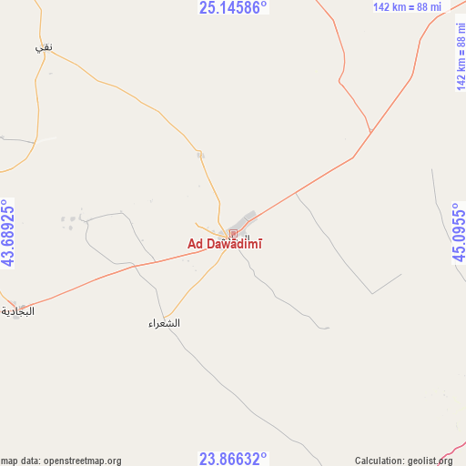
Ad Dawādimī GPS coordinates[2]
24° 30' 27.792" North, 44° 23' 32.532" East
| Map corner | latitude | longitude |
|---|---|---|
| Upper-left | 25.14586°, | 43.68925° |
| Center: | 24.50772°, | 44.39237° |
| Lower-right: | 23.86632°, | 45.0955° |
| Map W x H: | 142.3×142.3 km | = 88.4×88.4mi |
| max Lat: | 31.67252° ⇑61.9% North |
| Ad Dawādimī: | 24.50772° |
| min Lat: | ⇓38.1% South 16.57946° |
| min Long | Ad Dawādimī | max Long |
| 35.69014° | 44.39237° | 54.09599° |
| W 56.7%⇐ | ⇒43.3% E |
Elevation
Elevation of Ad Dawādimī is 975 m = 3199 ft, and this is 453.6 m = 1488 ft above average elevation for this country.
| Max E: |
2385 m = 7825 ft | 16.5% |
| Ad Dawādimī | 975 m 3199 ft | |
| Avg. | 521.4 m = 1711 ft | |
Min E: |
3 m = 10 ft | 83.5% |
See also: Ad Dawādimī elevation on elevation.city.
Geographical zone
Ad Dawādimī is located in North temperate zone (between Tropic of Cancer and the Arctic Circle). Distance of this Northern Tropic circle is 119.1 km =74 mi to South.| Distance of | km | miles | from Ad Dawādimī |
|---|---|---|---|
| North Pole | 7282.1 | 4524.9 | to North |
| Arctic Circle | 4676.2 | 2905.7 | to North |
| Tropic Cancer | 119.1 | 74 | to South |
| Equator | 2725 | 1693.2 | to South |


Nearby cities:
15 places around Ad Dawādimī: (largest is in red/bold)
• Afif
163.9 km =101.8 mi,  245°
245°
• Ain AlBaraha
68.4 km =42.5 mi,  294°
294°
• Al Bukayrīyah
195.8 km =121.7 mi,  337°
337°
• Al Majma‘ah
183.7 km =114.1 mi,  31°
31°
• Al Mithnab
151.3 km =94 mi,  353°
353°
• Alrmtheiah
147.6 km =91.7 mi,  280°
280°
• Ar Rass
176.2 km =109.5 mi,  329°
329°
• Az Zulfī
203.7 km =126.6 mi,  12°
12°
• Buraydah
206.5 km =128.3 mi, 348°
• Marāt
124.4 km =77.3 mi,  59°
59°
• Sājir
77.9 km =48.4 mi,  15°
15°
• Tumayr
199.4 km =123.9 mi,  48°
48°
• Unaizah
180.9 km =112.4 mi, 346°
• Wed Alnkil
187.4 km =116.4 mi,  303°
303°
• shokhaibٍ
189.9 km =118 mi,  90°
90°
Sources, notices
• [Note1] Compared only with cities in Saudi Arabia existing in our database
• [Src1] Map data: © OpenStreetMap contributors (CC-BY-SA)
• [Src2] Other city data from geonames.org with taken over terms of usage.
• [Src3] Geographical zone / Annual Mean Temperature by Robert A. Rohde @ Wikipedia
