Västerfärnebo geodata
Västerfärnebo (Västmanland) is a populated place; located in Sweden in Europe/Stockholm (GMT+2) time zone. With population of 533 people, there are 1266 cities with bigger population in this country. Compared to other cities in Sweden, 73.1% of cities are located further ↓South; 65.1% of cities are located further ←West and 61.2% of cities have lower elevation than Västerfärnebo. Note1


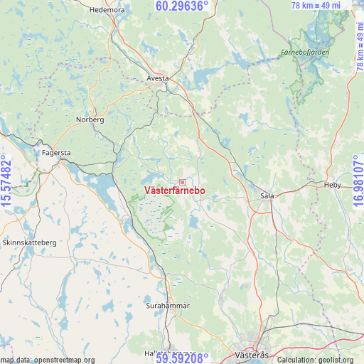
Västerfärnebo GPS coordinates[2]
59° 56' 45.924" North, 16° 16' 40.584" East
| Map corner | latitude | longitude |
|---|---|---|
| Upper-left | 60.29636°, | 15.57482° |
| Center: | 59.94609°, | 16.27794° |
| Lower-right: | 59.59208°, | 16.98107° |
| Map W x H: | 78.3×78.3 km | = 48.7×48.7mi |
| max Lat: | 67.85572° ⇑26.9% North |
| Västerfärnebo: | 59.94609° |
| min Lat: | ⇓73.1% South 55.34337° |
| min Long | Västerfärnebo | max Long |
| 11.1712° | 16.27794° | 24.13676° |
| W 65.1%⇐ | ⇒34.9% E |
Elevation
Elevation of Västerfärnebo is 73 m = 240 ft, and this is 9.6 m = 31 ft below average elevation for this country.
| Max E: |
663 m = 2175 ft | 38.8% |
| Avg. | 82.6 m = 271 ft | |
| Västerfärnebo | 73 m = 240 ft | |
Min E: |
-1 m = -3 ft | 61.2% |
See also: Sweden elevation on elevation.city.
Geographical zone
Västerfärnebo is located in North temperate zone (between Tropic of Cancer and the Arctic Circle). Distance of this North polar circle is 735.8 km =457.2 mi to North.| Distance of | km | miles | from Västerfärnebo |
|---|---|---|---|
| North Pole | 3341.7 | 2076.4 | to North |
| Arctic Circle | 735.8 | 457.2 | to North |
| Tropic Cancer | 4059.5 | 2522.5 | to South |
| Equator | 6665.4 | 4141.7 | to South |


Nearby cities:
15 places around Västerfärnebo: (largest is in red/bold)
• Annelund
14.9 km =9.3 mi,  293°
293°
• Avesta
22.8 km =14.2 mi,  343°
343°
• Fagersta
27.7 km =17.2 mi,  283°
283°
• Fors
29.1 km =18.1 mi,  3°
3°
• Heby
32.5 km =20.2 mi,  91°
91°
• Krylbo
21.1 km =13.1 mi,  350°
350°
• Norberg
23.7 km =14.7 mi,  303°
303°
• Ramnäs
20.4 km =12.7 mi,  192°
192°
• Ransta
25.1 km =15.6 mi,  126°
126°
• Råby
17.8 km =11.1 mi,  16°
16°
• Sala
18.5 km =11.5 mi,  99°
99°
• Sjövik
22.8 km =14.2 mi,  5°
5°
• Skultuna
26.7 km =16.6 mi,  163°
163°
• Surahammar
26.7 km =16.6 mi, 186°
• Tillberga
34.8 km =21.6 mi,  147°
147°
Sources, notices
• [Note1] Compared only with cities in Sweden existing in our database
• [Src1] Map data: © OpenStreetMap contributors (CC-BY-SA)
• [Src2] Other city data from geonames.org with taken over terms of usage.
• [Src3] Geographical zone / Annual Mean Temperature by Robert A. Rohde @ Wikipedia
