Upphärad geodata
Upphärad (Västra Götaland) is a populated place; located in Sweden in Europe/Stockholm (GMT+2) time zone. With population of 572 people, there are 1208 cities with bigger population in this country. Compared to other cities in Sweden, 58.4% of cities are located further ↑North; 90.5% of cities are located further →East and 61.2% of cities have lower elevation than Upphärad. Note1


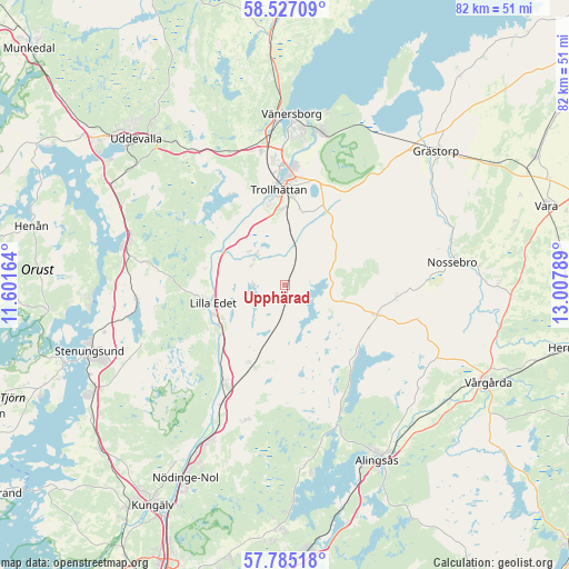
Upphärad GPS coordinates[2]
58° 9' 29.052" North, 12° 18' 17.136" East
| Map corner | latitude | longitude |
|---|---|---|
| Upper-left | 58.52709°, | 11.60164° |
| Center: | 58.15807°, | 12.30476° |
| Lower-right: | 57.78518°, | 13.00789° |
| Map W x H: | 82.5×82.5 km | = 51.3×51.3mi |
| max Lat: | 67.85572° ⇑58.4% North |
| Upphärad: | 58.15807° |
| min Lat: | ⇓41.6% South 55.34337° |
| min Long | Upphärad | max Long |
| 11.1712° | 12.30476° | 24.13676° |
| W 9.5%⇐ | ⇒90.5% E |
Elevation
Elevation of Upphärad is 73 m = 240 ft, and this is 9.6 m = 31 ft below average elevation for this country.
| Max E: |
663 m = 2175 ft | 38.8% |
| Avg. | 82.6 m = 271 ft | |
| Upphärad | 73 m = 240 ft | |
Min E: |
-1 m = -3 ft | 61.2% |
See also: Sweden elevation on elevation.city.
Geographical zone
Upphärad is located in North temperate zone (between Tropic of Cancer and the Arctic Circle). Distance of this North polar circle is 934.6 km =580.7 mi to North.| Distance of | km | miles | from Upphärad |
|---|---|---|---|
| North Pole | 3540.5 | 2200 | to North |
| Arctic Circle | 934.6 | 580.7 | to North |
| Tropic Cancer | 3860.7 | 2398.9 | to South |
| Equator | 6466.6 | 4018.2 | to South |


Nearby cities:
15 places around Upphärad: (largest is in red/bold)
• Göta
10.6 km =6.6 mi,  237°
237°
• Lilla Edet
10.4 km =6.5 mi,  254°
254°
• Ljungskile
23.7 km =14.7 mi,  288°
288°
• Lödöse
16.6 km =10.3 mi,  210°
210°
• Nossebro
24.3 km =15.1 mi,  82°
82°
• Sjuntorp
7 km =4.3 mi,  312°
312°
• Skepplanda
20.4 km =12.7 mi,  197°
197°
• Sollebrunn
14.2 km =8.8 mi,  108°
108°
• Sålanda
20.1 km =12.5 mi,  194°
194°
• Trollhättan
14 km =8.7 mi,  356°
356°
• Ucklum
22.4 km =13.9 mi, 248°
• Vargön
22.6 km =14 mi,  12°
12°
• Velanda
7.9 km =4.9 mi,  2°
2°
• Vänersborg
24.8 km =15.4 mi, 2°
• Älvängen
24.6 km =15.3 mi, 205°
Sources, notices
• [Note1] Compared only with cities in Sweden existing in our database
• [Src1] Map data: © OpenStreetMap contributors (CC-BY-SA)
• [Src2] Other city data from geonames.org with taken over terms of usage.
• [Src3] Geographical zone / Annual Mean Temperature by Robert A. Rohde @ Wikipedia
