Stehag geodata
Stehag (Skåne) is a populated place; located in Sweden in Europe/Stockholm (GMT+2) time zone. With population of 1,191 people, there are 749 cities with bigger population in this country. Compared to other cities in Sweden, 93.8% of cities are located further ↑North; 72.9% of cities are located further →East and 56.2% of cities have lower elevation than Stehag. Note1
Administrative division(s):
- Level 1: Skåne
- Level 2: Eslövs Kommun
- Level 3: Östra Onsjö
- Level 4: Stehag socken


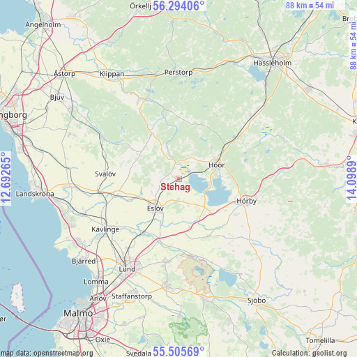
Stehag GPS coordinates[2]
55° 54' 6.768" North, 13° 23' 44.772" East
| Map corner | latitude | longitude |
|---|---|---|
| Upper-left | 56.29406°, | 12.69265° |
| Center: | 55.90188°, | 13.39577° |
| Lower-right: | 55.50569°, | 14.0989° |
| Map W x H: | 87.7×87.7 km | = 54.5×54.5mi |
| max Lat: | 67.85572° ⇑93.8% North |
| Stehag: | 55.90188° |
| min Lat: | ⇓6.2% South 55.34337° |
| min Long | Stehag | max Long |
| 11.1712° | 13.39577° | 24.13676° |
| W 27.1%⇐ | ⇒72.9% E |
Elevation
Elevation of Stehag is 62 m = 203 ft, and this is 20.6 m = 68 ft below average elevation for this country.
| Max E: |
663 m = 2175 ft | 43.8% |
| Avg. | 82.6 m = 271 ft | |
| Stehag | 62 m = 203 ft | |
Min E: |
-1 m = -3 ft | 56.2% |
See also: Sweden elevation on elevation.city.
Geographical zone
Stehag is located in North temperate zone (between Tropic of Cancer and the Arctic Circle). Distance of this North polar circle is 1185.5 km =736.6 mi to North.| Distance of | km | miles | from Stehag |
|---|---|---|---|
| North Pole | 3791.4 | 2355.9 | to North |
| Arctic Circle | 1185.5 | 736.6 | to North |
| Tropic Cancer | 3609.8 | 2243 | to South |
| Equator | 6215.7 | 3862.3 | to South |


Nearby cities:
15 places around Stehag: (largest is in red/bold)
• Eslöv
9 km =5.6 mi,  219°
219°
• Flyinge
16.6 km =10.3 mi,  186°
186°
• Hörby
17.4 km =10.8 mi,  108°
108°
• Höör
9.6 km =6 mi,  67°
67°
• Ljungbyhed
21.5 km =13.4 mi,  333°
333°
• Ludvigsborg
12.7 km =7.9 mi,  90°
90°
• Löberöd
16.1 km =10 mi,  150°
150°
• Marieholm
15.8 km =9.8 mi,  255°
255°
• Röstånga
13 km =8.1 mi, 327°
• Stångby
20.9 km =13 mi, 216°
• Svalöv
18 km =11.2 mi,  274°
274°
• Sätofta
9.8 km =6.1 mi,  80°
80°
• Södra Sandby
20.8 km =12.9 mi, 188°
• Teckomatorp
19.9 km =12.4 mi, 258°
• Tjörnarp
17.8 km =11.1 mi,  54°
54°
Sources, notices
• [Note1] Compared only with cities in Sweden existing in our database
• [Src1] Map data: © OpenStreetMap contributors (CC-BY-SA)
• [Src2] Other city data from geonames.org with taken over terms of usage.
• [Src3] Geographical zone / Annual Mean Temperature by Robert A. Rohde @ Wikipedia
