Skattkärr geodata
Skattkärr (Värmland) is a populated place; located in Sweden in Europe/Stockholm (GMT+2) time zone. With population of 1,979 people, there are 524 cities with bigger population in this country. Compared to other cities in Sweden, 64.3% of cities are located further ↓South; 68.3% of cities are located further →East and 57% of cities have lower elevation than Skattkärr. Note1


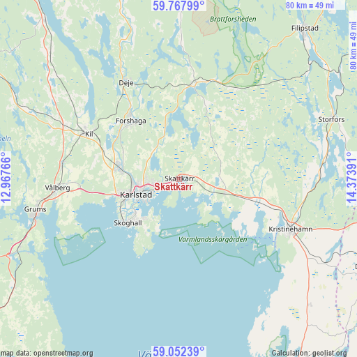
Skattkärr GPS coordinates[2]
59° 24' 43.488" North, 13° 40' 14.808" East
| Map corner | latitude | longitude |
|---|---|---|
| Upper-left | 59.76799°, | 12.96766° |
| Center: | 59.41208°, | 13.67078° |
| Lower-right: | 59.05239°, | 14.37391° |
| Map W x H: | 79.6×79.6 km | = 49.5×49.5mi |
| max Lat: | 67.85572° ⇑35.7% North |
| Skattkärr: | 59.41208° |
| min Lat: | ⇓64.3% South 55.34337° |
| min Long | Skattkärr | max Long |
| 11.1712° | 13.67078° | 24.13676° |
| W 31.7%⇐ | ⇒68.3% E |
Elevation
Elevation of Skattkärr is 63 m = 207 ft, and this is 19.6 m = 64 ft below average elevation for this country.
| Max E: |
663 m = 2175 ft | 43% |
| Avg. | 82.6 m = 271 ft | |
| Skattkärr | 63 m = 207 ft | |
Min E: |
-1 m = -3 ft | 57% |
See also: Sweden elevation on elevation.city.
Geographical zone
Skattkärr is located in North temperate zone (between Tropic of Cancer and the Arctic Circle). Distance of this North polar circle is 795.2 km =494.1 mi to North.| Distance of | km | miles | from Skattkärr |
|---|---|---|---|
| North Pole | 3401.1 | 2113.3 | to North |
| Arctic Circle | 795.2 | 494.1 | to North |
| Tropic Cancer | 4000.1 | 2485.5 | to South |
| Equator | 6606 | 4104.8 | to South |


Nearby cities:
15 places around Skattkärr: (largest is in red/bold)
• Alster
3.6 km =2.2 mi,  244°
244°
• Deje
24 km =14.9 mi,  332°
332°
• Edsvalla
26.2 km =16.3 mi,  275°
275°
• Forshaga
16.5 km =10.3 mi,  319°
319°
• Grums
32.4 km =20.1 mi,  257°
257°
• Karlstad
10.1 km =6.3 mi,  248°
248°
• Kil
22.6 km =14 mi,  296°
296°
• Kristinehamn
27.3 km =17 mi,  114°
114°
• Molkom
21.1 km =13.1 mi,  7°
7°
• Råtorp
10.2 km =6.3 mi, 263°
• Skoghall
15.3 km =9.5 mi,  229°
229°
• Skåre
13.6 km =8.5 mi, 279°
• Vallargärdet
8.7 km =5.4 mi, 326°
• Väse
10.7 km =6.6 mi, 107°
• Vålberg
27.5 km =17.1 mi,  265°
265°
Sources, notices
• [Note1] Compared only with cities in Sweden existing in our database
• [Src1] Map data: © OpenStreetMap contributors (CC-BY-SA)
• [Src2] Other city data from geonames.org with taken over terms of usage.
• [Src3] Geographical zone / Annual Mean Temperature by Robert A. Rohde @ Wikipedia
