Väse geodata
Väse (Värmland) is a populated place; located in Sweden in Europe/Stockholm (GMT+2) time zone. With population of 519 people, there are 1287 cities with bigger population in this country. Compared to other cities in Sweden, 63% of cities are located further ↓South; 65.9% of cities are located further →East and 55.6% of cities have lower elevation than Väse. Note1
Administrative division(s):
- Level 1: Värmland
- Level 2: Karlstads Kommun
- Level 3: Väse-Fågelvik
- Level 4: Väse socken


Väse GPS coordinates[2]
59° 22' 56.964" North, 13° 51' 3.348" East
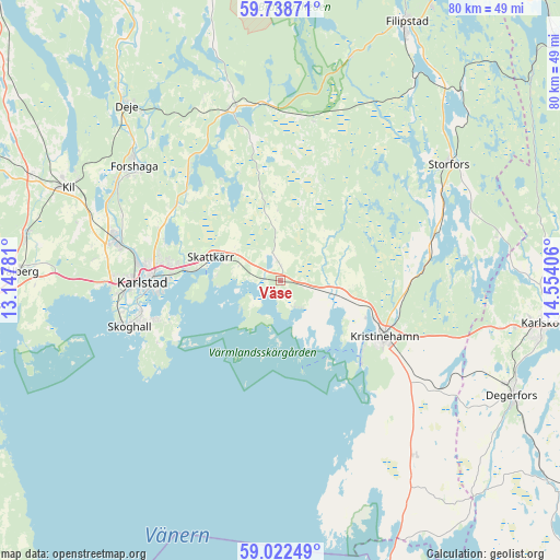
| Map corner | latitude | longitude |
|---|---|---|
| Upper-left | 59.73871°, | 13.14781° |
| Center: | 59.38249°, | 13.85093° |
| Lower-right: | 59.02249°, | 14.55406° |
| Map W x H: | 79.6×79.6 km | = 49.5×49.5mi |
| max Lat: | 67.85572° ⇑37% North |
| Väse: | 59.38249° |
| min Lat: | ⇓63% South 55.34337° |
| min Long | Väse | max Long |
| 11.1712° | 13.85093° | 24.13676° |
| W 34.1%⇐ | ⇒65.9% E |
Elevation
Elevation of Väse is 60 m = 197 ft, and this is 22.6 m = 74 ft below average elevation for this country.
| Max E: |
663 m = 2175 ft | 44.4% |
| Avg. | 82.6 m = 271 ft | |
| Väse | 60 m = 197 ft | |
Min E: |
-1 m = -3 ft | 55.6% |
See also: Sweden elevation on elevation.city.
Geographical zone
Väse is located in North temperate zone (between Tropic of Cancer and the Arctic Circle). Distance of this North polar circle is 798.5 km =496.2 mi to North.| Distance of | km | miles | from Väse |
|---|---|---|---|
| North Pole | 3404.3 | 2115.3 | to North |
| Arctic Circle | 798.5 | 496.2 | to North |
| Tropic Cancer | 3996.8 | 2483.5 | to South |
| Equator | 6602.7 | 4102.7 | to South |


Nearby cities:
15 places around Väse: (largest is in red/bold)
• Alster
13.5 km =8.4 mi,  277°
277°
• Björneborg
27.5 km =17.1 mi,  124°
124°
• Deje
32.5 km =20.2 mi,  318°
318°
• Forshaga
26.2 km =16.3 mi,  307°
307°
• Karlstad
19.7 km =12.2 mi,  268°
268°
• Kil
33.2 km =20.6 mi,  293°
293°
• Kristinehamn
16.7 km =10.4 mi, 119°
• Molkom
25.3 km =15.7 mi,  343°
343°
• Råtorp
20.5 km =12.7 mi, 276°
• Sjötorp
25.2 km =15.7 mi,  63°
63°
• Skattkärr
10.7 km =6.6 mi, 287°
• Skoghall
22.8 km =14.2 mi,  253°
253°
• Skåre
24.3 km =15.1 mi, 283°
• Storfors
29 km =18 mi, 55°
• Vallargärdet
18.4 km =11.4 mi, 305°
Sources, notices
• [Note1] Compared only with cities in Sweden existing in our database
• [Src1] Map data: © OpenStreetMap contributors (CC-BY-SA)
• [Src2] Other city data from geonames.org with taken over terms of usage.
• [Src3] Geographical zone / Annual Mean Temperature by Robert A. Rohde @ Wikipedia
